
Winter Walk to the Waskahegan Fire Tower
·222 words·2 mins
I thought I’d share the experience using some software I’m trying out:
- Knight Lab StoryMapJS which displays a map along with media like images or video in a slide format, and
- the Kuula image sharing site for the first time. There’s a 360 image hosted on Kuula on each slide in the StoryMap and the images were sometimes slow to load. Please have patience.
- Also, if you see a “play” button on the image, click it to load the 360 image, then use your mouse to drag the image around. And I have to say all of this is much better experienced on a computer screen vs a smaller mobile screen.
Sharing the trip experience in this way is a bit of an experiment, so if some of it doesn’t work out, well, I’ll just chalk it up to science.
Click the image below to launch the StoryMap in a new browser window.
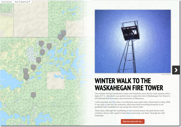
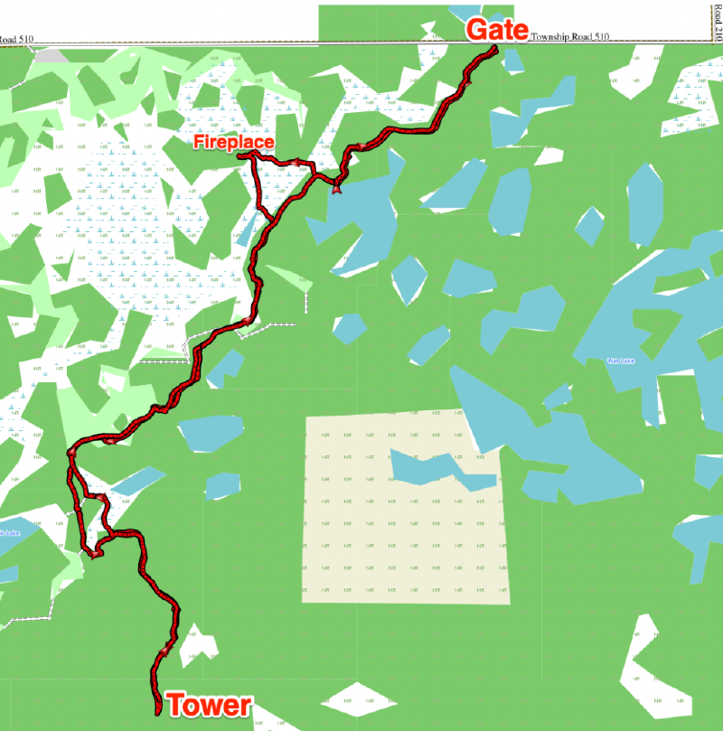
My Route Today#

Author
Grant S Wilson
Related
Hike to Oliver Lake to Find Two New Geocaches
·590 words·3 mins
My goal for the day was to find two new caches hidden by Jazzhiker who, like me, came to geocaching via hiking.
Ministik South Recon Hike
·1387 words·7 mins
This recon hike was made and the blog post written early in my explorations of the Ministik Bird Sanctuary. It’s fun for me to relive the experience these days when the area is well-known to me.
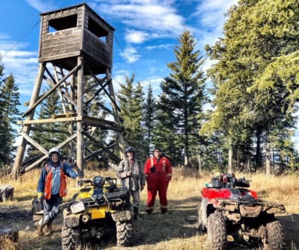
Quad Trek to Grizzly Ridge Tower
·1793 words·9 mins
I’d been “map-dreaming” for literally years about making the trek to Grizzly Ridge Tower. I’d even tried and failed once foiled by muddy roads. But because of the kindness of friends, I was finally able to get there.