West Highland Way - Day 7 - Kinlochleven to Fort William
West Highland Way - 2026 - This article is part of a series.
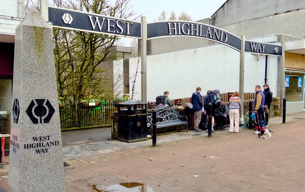
What is the West Highland Way?
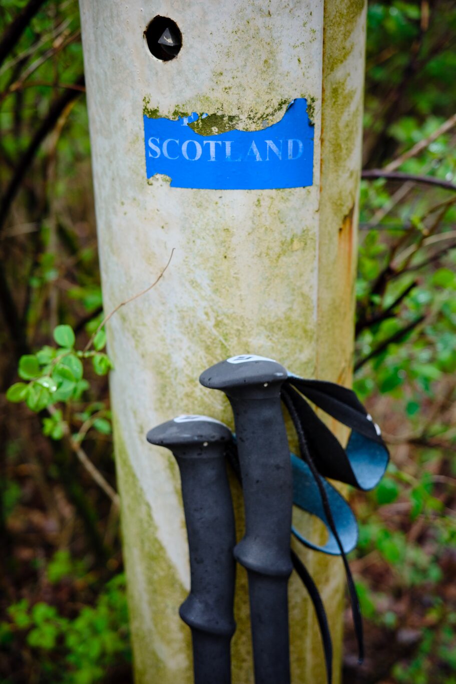
The West Highland Way is a 154 km (9 mile) walking trail in Scotland, running from Milngavie (near Glasgow) to Fort William. It passes through diverse landscapes, including Loch Lomond, open moors, and mountainous terrains. You can view entire route here. (Map by Westhighlandway.org
My Route Today#
Breakfast at Allt-na-Leven Guesthouse#
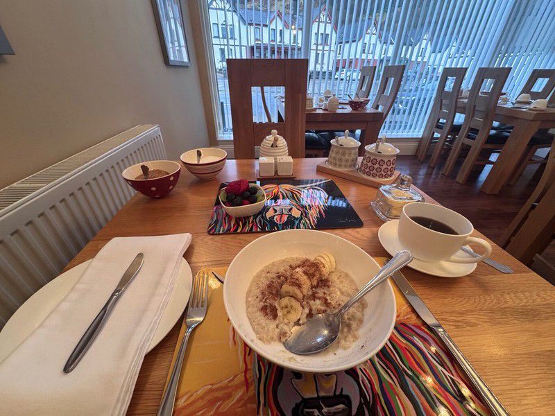
I had breakfast at 7:30, thinking I wanted to get off on the trail a little earlier than usual since it would be a longer distance than the previous day. In addition to whatever you wanted from their fridge — it had yogurt and a lot of other stuff in there — they gave you porridge with a banana and cinnamon for starters and then followed with the full breakfast when you were finished that.
With the full breakfast it was like pure magical gold to see an actual small bowl of fruit too: raspberries, melon, and blackberries I couldn’t identify. It was so fresh and good. I told the husband who was serving that it was such a treat to be able to eat some fruit.
The complete experience at this guesthouse was A+ from start to finish.
Starting Out from Kinlochleven#
Today was the final leg of the entire trek. I remember a certain giddy feeling at that thought, laced with both a feeling of relief and, yes, a bit of regret too.
I’d had a very good sleep again the night before — that was two nights in a row. The cold symptoms had subsided to a degree; I was still coughing and having to clear out my nose, but just less frequently than the few days before.
The forecast was for rain the entire day. On the way out, the husband said he thought it wouldn’t be raining the whole day, but would be intermittent, and in fact, as I started out at around 8:20 a.m., there was only a light misty rain in the air.
After walking through to the north side of town on sidewalks, I followed the Way marker across the road, off and very soon up into the forest. That started me on a long, slow, gruelling climb that lasted for a good long while. I’ve seen a YouTube video where the hiker agrees with others on the trail that the climb up from Kinlochleven wasn’t all that bad, much better than they expected. Personally, I found it to be a slog, but then again, being a prairie boy born and bred, gaining elevation and I have never gotten along, plus my health still wasn’t anywhere near 100%.
In fact, once back home I compared the elevation gain of the Devil’s Staircase, which I’d done the day before, with the climb from Kinlochleven. The Kinlochleven climb is almost exactly the same as the Devil’s Staircase, but over a longer distance. No wonder I had to take numerous rests on the way up.
I found the climb tough, but I tried to heed the words of Ben Gadd, with whom I’d had the pleasure of spending five days during a course in Jasper, Alberta many years ago: “Take it easy, but take it,” he would say. I just had to remember to take it easy but stay determined to always forge ahead; there was no race to be won here, but it had to be finished.
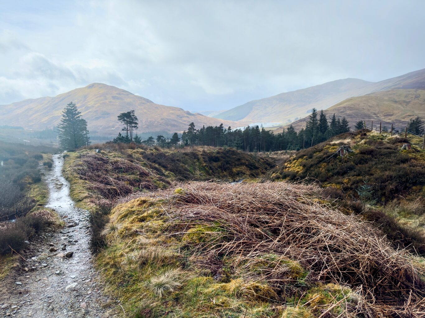
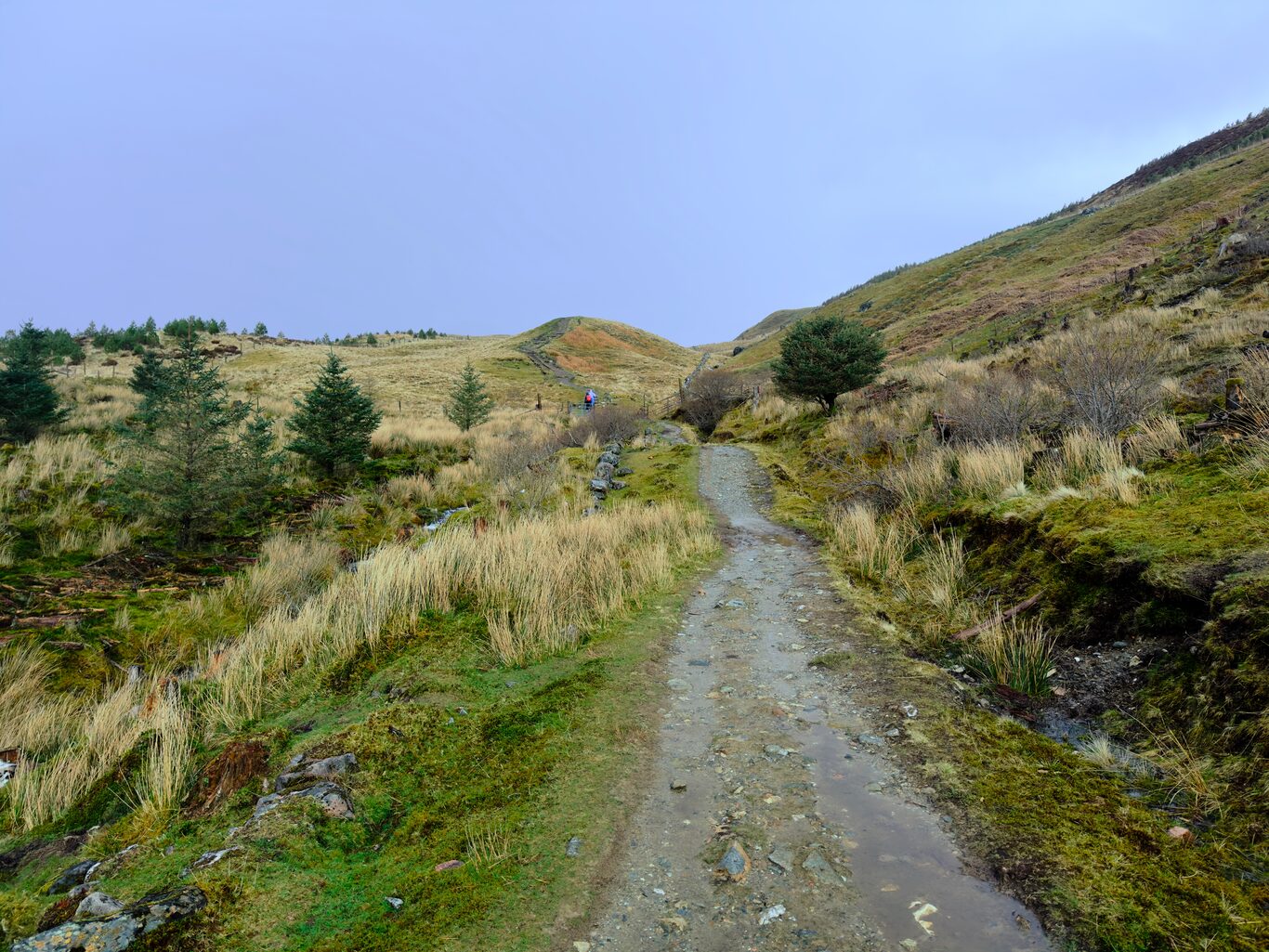
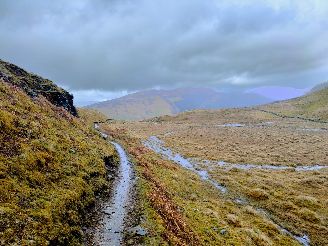
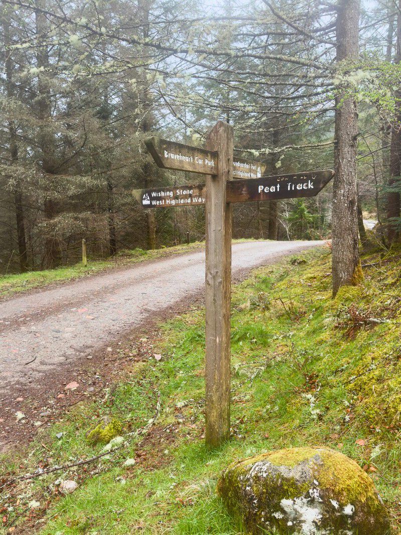
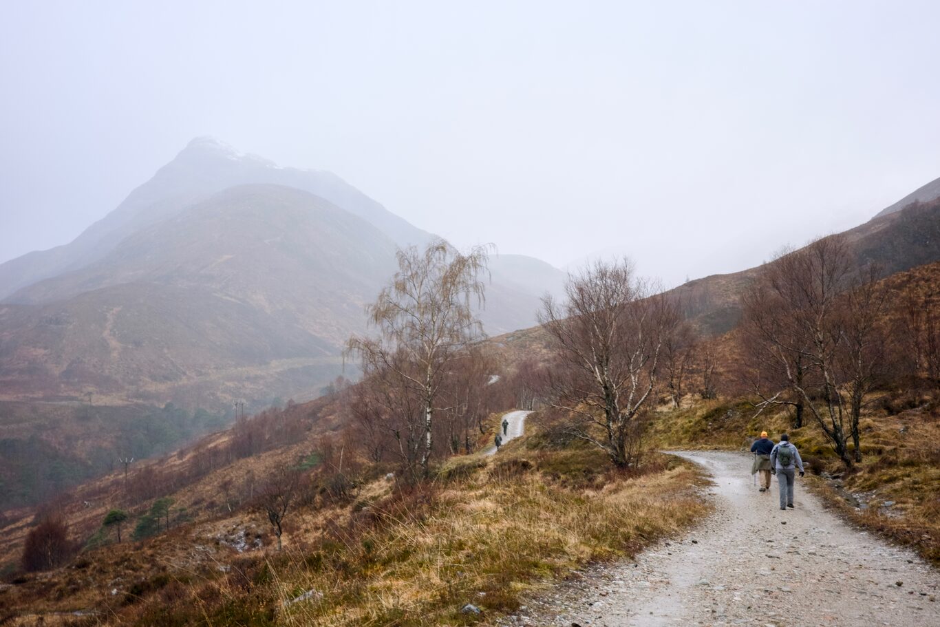
After most of the elevation gain was achieved, the rocky single-track trail transitioned to an old, rocky military road. These military roads were built by the British around 1752 as part of the campaign to control the Scottish Highlands.
Onto the Military Road and Up the Creek…#
Over the past few days, I had honestly successfully held on to the mindset that anything I faced along the trail — the effort to climb hills, the sometimes furious wind, the pelting rain and occasional stinging sleet at higher altitudes — just had to be accepted as part of what I’d signed up for. There was no use complaining about these things; whatever the conditions, they were simply what needed to be accepted as part of the experience I’d willingly signed up for. But during this stretch along the military road today, that stoic mindset was slowly chiseled away.
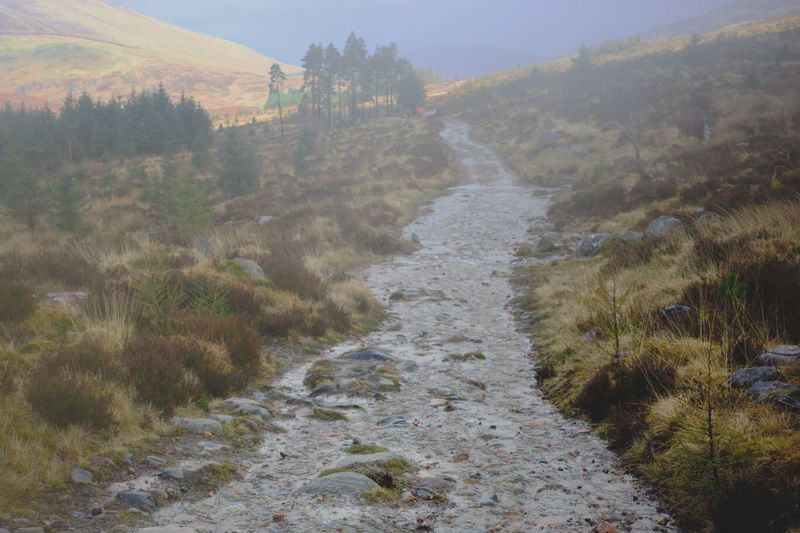
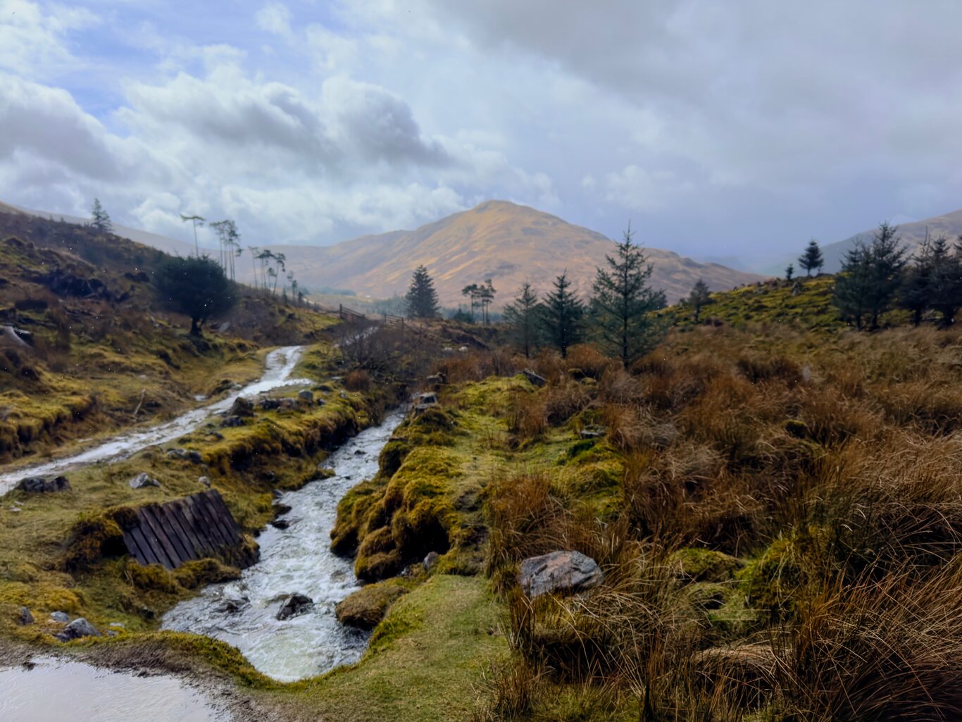
The road itself turned into a creek, and there was no option but to walk up the middle of the road through that creek.
At higher altitudes the wind was howling, forcing the falling rain sideways into your face. I distinctly remember walking at an angle into the needling rain, peppered with sleet by the wind, slooshing along the road that was now a flowing creek.
For a good part of the day I resorted to something I can’t remember ever doing before: I took off my glasses because they were so sopped with water and would get wet almost immediately after wiping them — that I could actually see the road ahead much better without them.
Finally, that stoic mindset of full acceptance of whatever I was faced with had evaporated. I pronounced out loud, “This is fucking miserable!”
That visceral truth was supported by others a little later along the trail. At the virtual cache “The Battle of Inverlochy” I was taking pictures of the signboard there for the sake of answering questions to be able to log the cache when a man and his wife caught up to me.
The husband started right off with the question, “So are you living in the UK right now and walking the trail, or did you travel here just to do the trail?” I must have greeted them somewhere along the trail today and they must have caught my foreign accent.
I told him I was from Canada and had come to walk the trail. Then somehow the talk transitioned to what we had just come through to get to that spot. He said it was “miserable”. I laughed, heartily agreed with him that it was indeed miserable, and it was so nice to hear a “local” say what I had been thinking. I felt vindicated for the lapse in my complete stoic acceptance.
Tigh-na-sleubhaich#
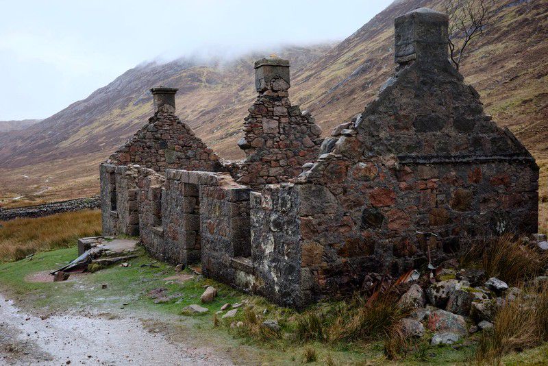
What I didn’t know until later is that it was still a viable structure used as a “bothy” — a place to camp out in overnight — until it was gutted by fire not that very long ago, in the early 1980s, just after the West Highland Way was first established.
Trail Pictures Along The Way#
(Click to see a larger version)
Camera Model: iPhone 15 Pro
Click for Map Location:N 56.7563806 W 5.1061278
Camera Model: iPhone 15 Pro
Click for Map Location:N 56.7564667 W 5.1060361
Camera Model: iPhone 15 Pro
Click for Map Location:N 56.7569917 W 5.1058583
Camera Model: iPhone 15 Pro
Click for Map Location:N 56.7615806 W 5.1042333
Camera Model: iPhone 15 Pro
Click for Map Location:N 56.7703611 W 5.0931083
Camera Model: iPhone 15 Pro
Click for Map Location:N 56.7715139 W 5.0891000
Finding “The Complete West Highland Way” Multicache#
Geocaching was not any kind of a priority while I walked the West Highland Way, but that said, there was one cache that was a “must find” for me, called The Complete West Highland Way. This is a “multi-cache”, which usually means the cache find is made up of multiple stages to visit before one can find the final cache to log it. In this case, the cache required you to answer questions about physical objects along the entire West Highland Way, starting in Milngavie and ending with questions about certain features of the Tigh-na-sleubhaich structure. This made it a truly epic kind of find.
In truth, I’d spent a few hours at home in Edmonton in front of the computer months before today, and because people take pictures of everything these days, I was able to eke out what I thought were the answers to the questions on the cache page and determine coordinates for the final, all before even starting the trek.
But with a multicache there’s no way to actually check those coordinates to see if they’re correct, and since some answers were based on educated guesses I couldn’t know if the final was actually going to be where I thought it should be.
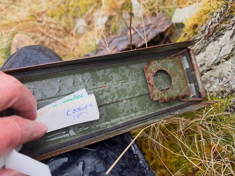
Others have said the final road-walking section of the last day’s leg seems to go on forever. That was certainly what I thought too. It also seemed like it took forever to get to the point along the road where I hoped to find the cache. But when I got to the coordinates, I saw a big stump — just what I expected — and glimpsed a part of a green ammo can under some pieces of bark, a classic geocache hiding spot. I had found it!
It was such a thrill to add my name to the logsheet in the cache. I’d been quietly anticipating the prospect of finding this cache for months. It was just so sweet to know it was now really happening.
And the heavens congratulated me by beginning to rain — again.
Finishing the West Highland Way#
I’d read descriptions that suggested another option, to simply continue on the road I’d been on, which would eventually take me closer to the centre of Fort William and would avoid that paved motorway. I thought about the options and thought I was just too physically and mentally tired to face what might be some wayfinding and possible detours when taking the “optional” route. I decided to keep to the known track I had on my GPSr despite the prospect of walking along a hard sidewalk on a paved road complete with car traffic. In retrospect, I think the optional route would have been better.
I continued along the seemingly antiseptic, entirely boring sidewalk along the paved road, and after passing the old end point of the WHW, I passed two young guys whom I recognized from previous days on the trail, maybe even the very first day. They must have recognized me too, because one said, “Ten more minutes — ten more minutes!”, meaning I only had to walk that long before the actual end point on High Street in Fort William.
By the time I got to High Street, which runs down the centre of Fort William and leads to the end point, I distinctly remember feeling like an alien from another dimension. The people I saw leading their normal lives didn’t have any idea what this hiker, who now felt like and probably looked like a drowned rat, had been through to get here.
I got to the end of the West Highland Way around 3:00 p.m. and was able to experience in person a scene I’d seen many times in pictures before today. My picture was different: I was the only one standing there, and by now the rain was coming down in earnest. (Click to see a larger version)
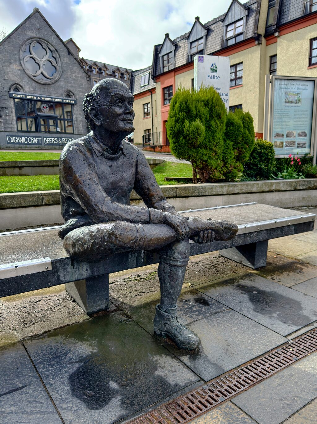
The sore feet statue at the official end of the West Highland Way (taken the day after I finished, this time without a downpour of rain).
Camera Model: iPhone 15 Pro
Click for Map Location:N 56.8163694 W 5.1138611
The sore feet statue at the official end of the West Highland Way (taken the day after I finished, this time without a downpour of rain).
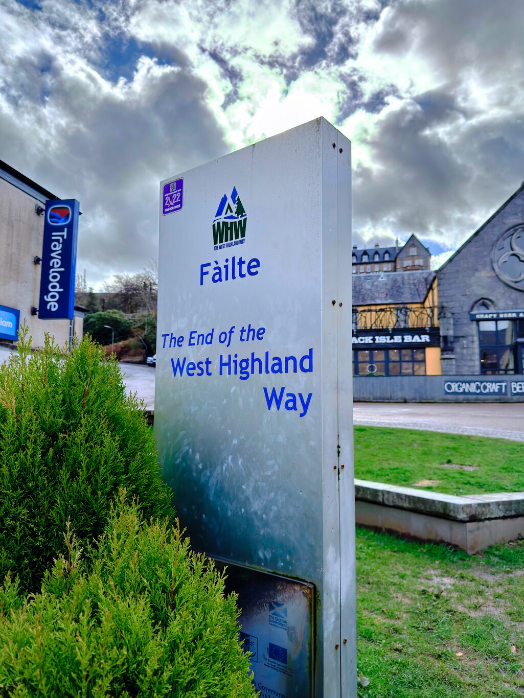
The official end of the West Highland Way - taken the day after finishing.
Camera Model: iPhone 15 Pro
Click for Map Location:N 56.8163194 W 5.1138750
The official end of the West Highland Way - taken the day after finishing.
But I’d finished the West Highland Way!
I should actually amend that to say I’d finished, but actually walked 80% of it, given that I was forced to take a day off due to sickness. I don’t feel an ounce of regret for taking that day to heal, and so the pride in finishing this long distance marathon trek is real, despite that gap.
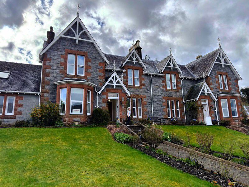
Myrtle Guesthouse - Fort William#
After taking some pictures of the “sore feet statue” at the end point, I continued to my accommodation for the night at Myrtle Guesthouse, a picturesque, stately old home which was a XX-minute walk from the end point.
My main goal at that point was to get out of my sopping wet clothes, into a hot shower, and then have a much-needed rest. After fetching my luggage and making my way to my room, that’s exactly what I did.
Gallery#
These images were taken throughout the day, and as you can see mostly in very wet, cloudy conditions. But that’s just the way the world is sometimes. Just accept it.
(Click to see a larger version)
This says it all - hiking in Scotland.
Camera Model: RICOH GR IIIx
Click for Map Location:N 56.7171500 W 4.9684444
This says it all - hiking in Scotland.
Misty conditions along the military road.
Camera Model: RICOH GR IIIx
Click for Map Location:N 56.7228528 W 4.9894611
Misty conditions along the military road.
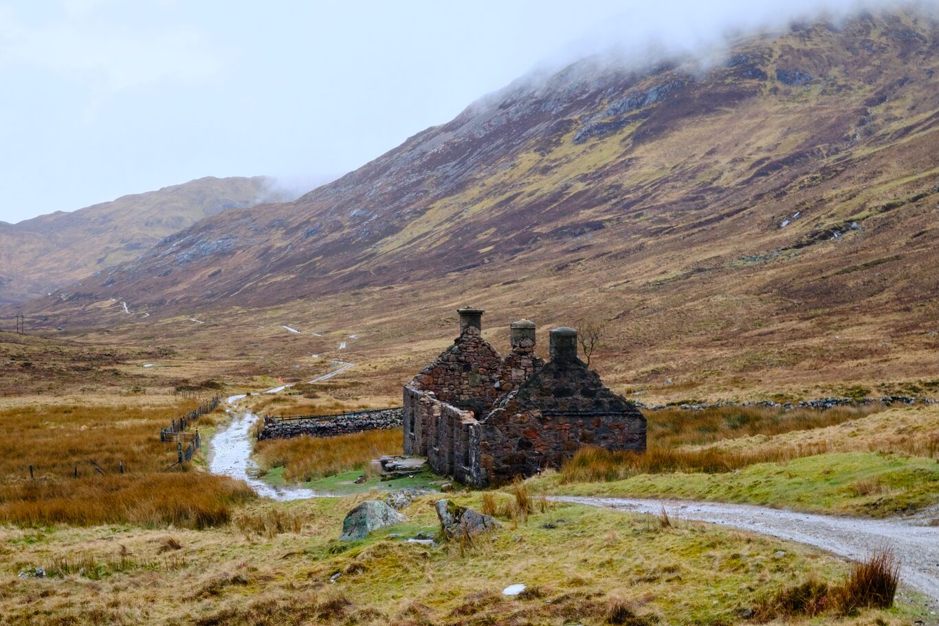
Tigh-na-sleubhaich or "ouse by the gullied slope."
Camera Model: RICOH GR IIIx
Click for Map Location:N 56.7330611 W 5.0464500
Tigh-na-sleubhaich or "ouse by the gullied slope."
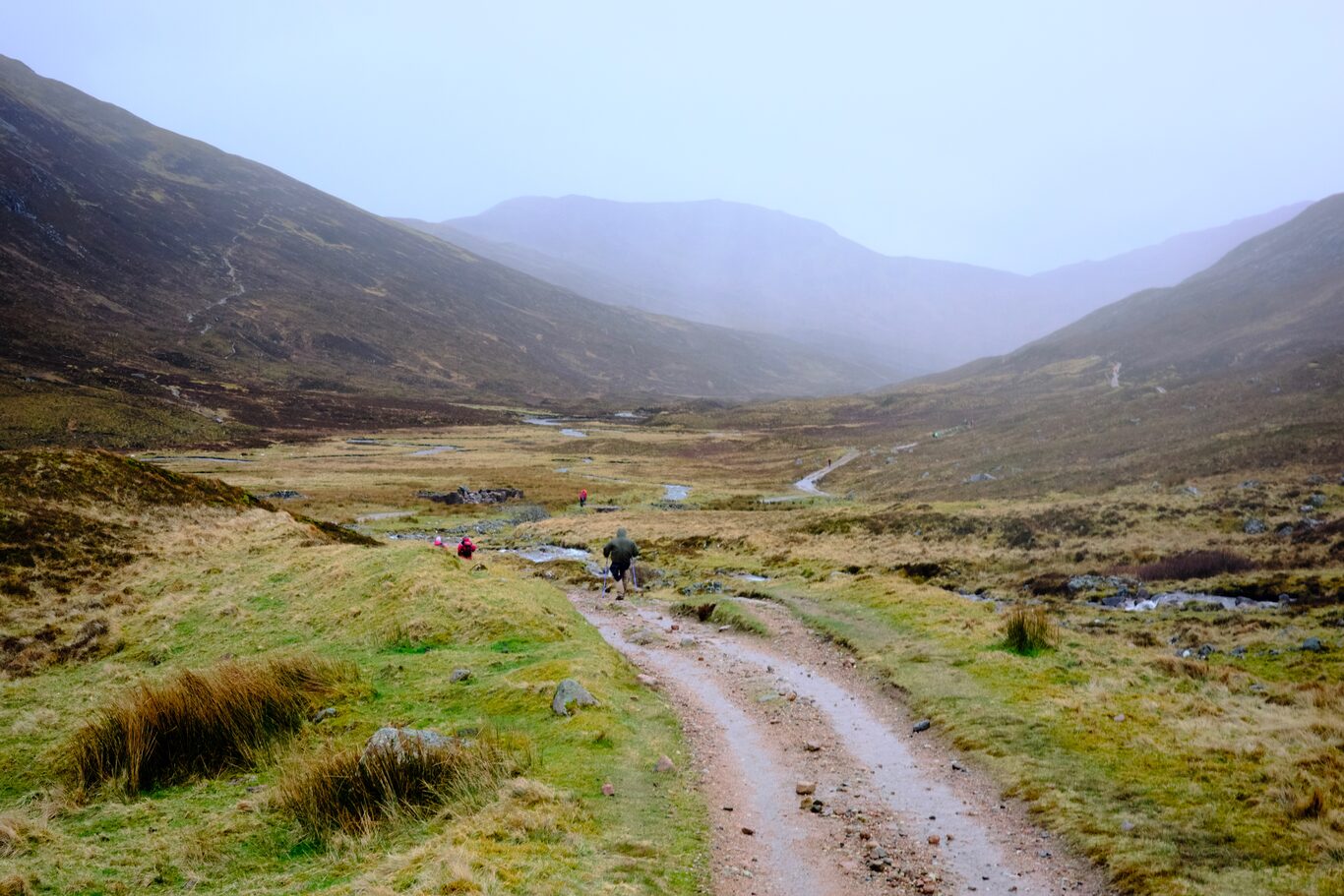
Hiking through the wide valley.
Camera Model: RICOH GR IIIx
Click for Map Location:N 56.7312194 W 5.0678222
Hiking through the wide valley.

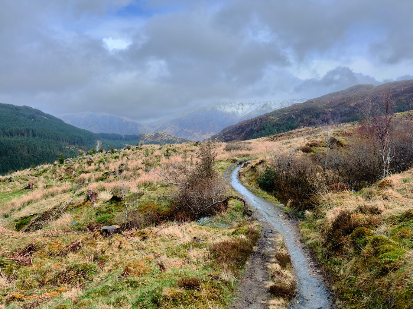
A break in the rain and on down the sloppy road.
Camera Model: iPhone 15 Pro
Click for Map Location:N 56.7448389 W 5.1097111
A break in the rain and on down the sloppy road.
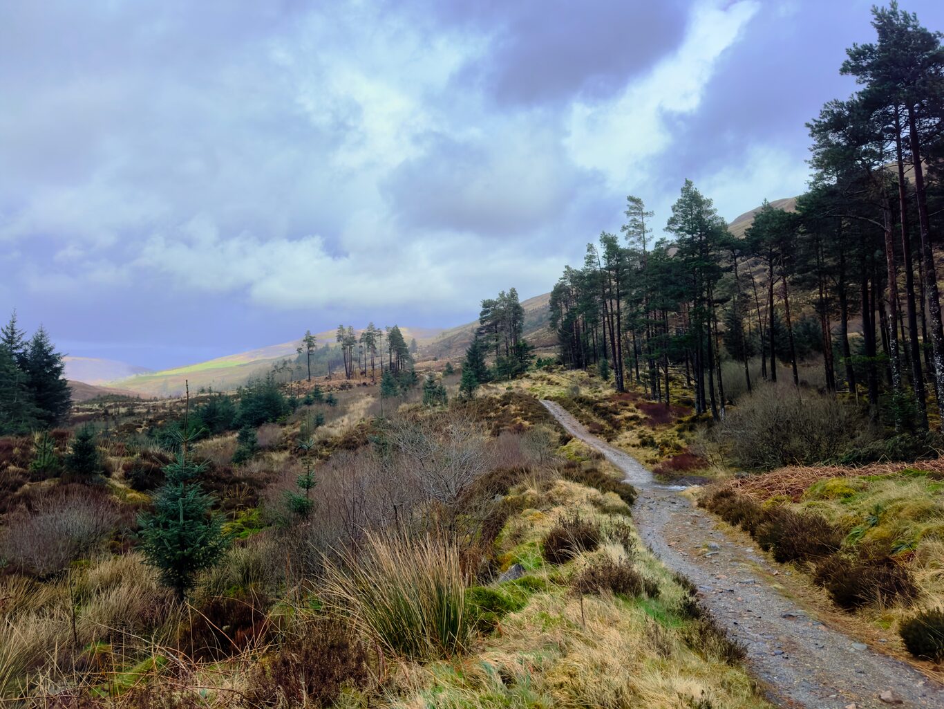
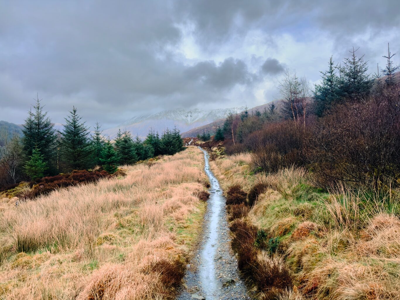
A pretty section of the trail.
Camera Model: iPhone 15 Pro
Click for Map Location:N 56.7474611 W 5.1100944
A pretty section of the trail.
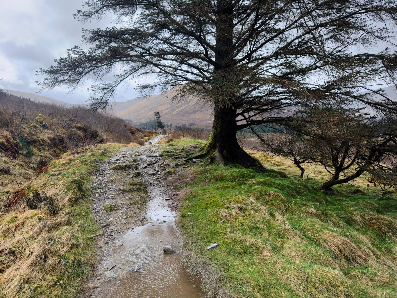
This tree was special to me. The wind was howling from the far side, and I sat on this side of it for shelter while eating some lunch.
Camera Model: iPhone 15 Pro
Click for Map Location:N 56.7552833 W 5.1065861
This tree was special to me. The wind was howling from the far side, and I sat on this side of it for shelter while eating some lunch.
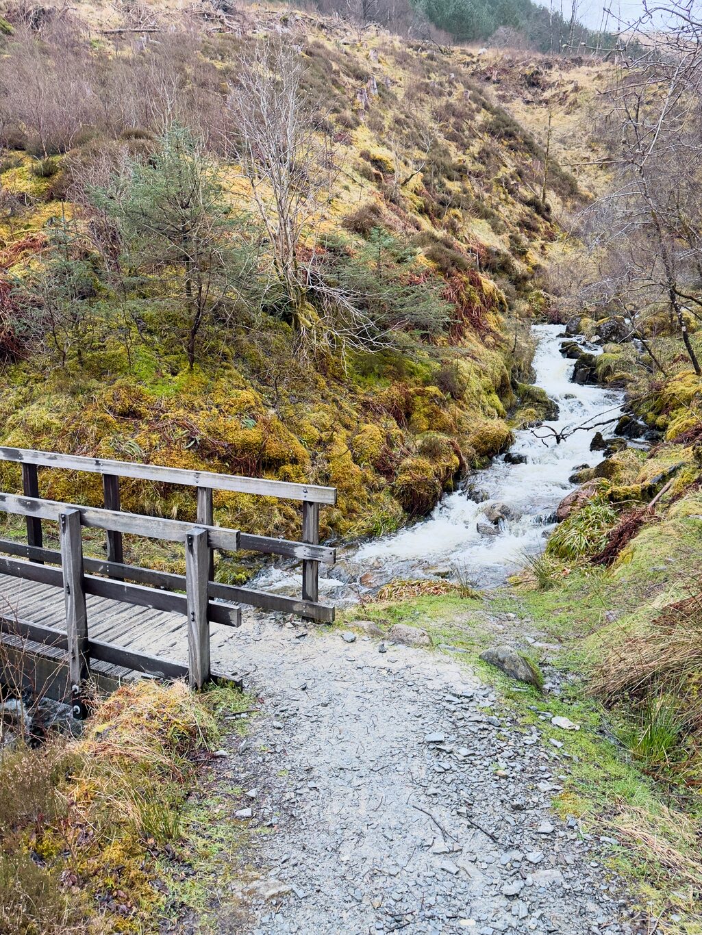
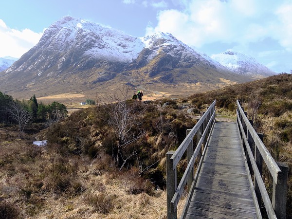
A little bridge over a rushing stream.
Camera Model: iPhone 15 Pro
Click for Map Location:N 56.7758750 W 5.0806028
A little bridge over a rushing stream.
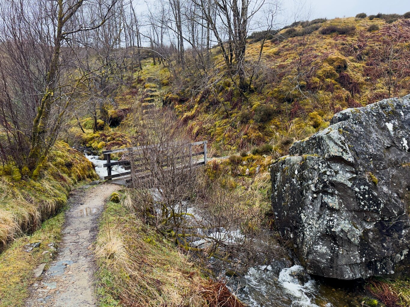
The bridge from another viewpoint, and notice the old, now moss-covered steps on the far bank.
Camera Model: iPhone 15 Pro
The bridge from another viewpoint, and notice the old, now moss-covered steps on the far bank.
The single-track trail transitioned to a proper road for the entire last section into Fort William.
Camera Model: iPhone 15 Pro
Click for Map Location:N 56.7880778 W 5.0730028
The single-track trail transitioned to a proper road for the entire last section into Fort William.

Closer to Fort William - this outcrop caught my attention.
Camera Model: iPhone 15 Pro
Click for Map Location:N 56.7992611 W 5.0783056
Closer to Fort William - this outcrop caught my attention.
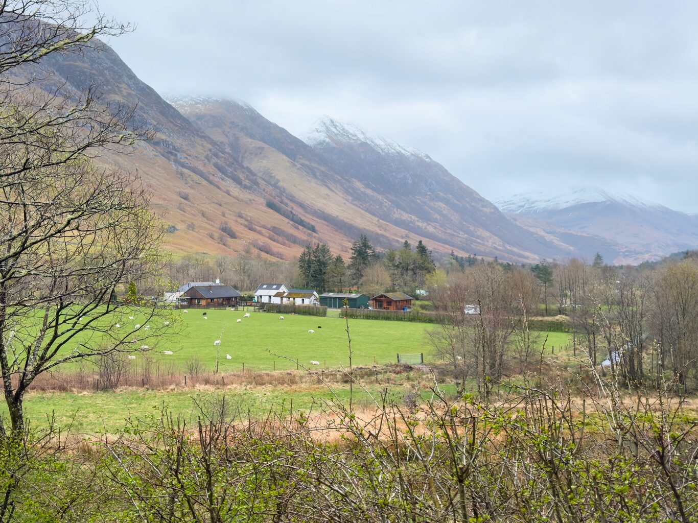
My first real glimpse of human settlement since leaving Kinlochleven this morning.
Camera Model: iPhone 15 Pro
Click for Map Location:N 56.8079250 W 5.0789861
My first real glimpse of human settlement since leaving Kinlochleven this morning.

This is the original end of the West Highland Way.
Camera Model: iPhone 15 Pro
Click for Map Location:N 56.8213194 W 5.0940444
This is the original end of the West Highland Way.

West Highland Way - 2026 - This article is part of a series.
Related
West Highland Way - Day 6 - Kingshouse Hotel to Kinlochleven
West Highland Way - Day 2 - Drymen to Rowardennan