West Highland Way - Day 6 - Kingshouse Hotel to Kinlochleven
West Highland Way - 2026 - This article is part of a series.
What is the West Highland Way?
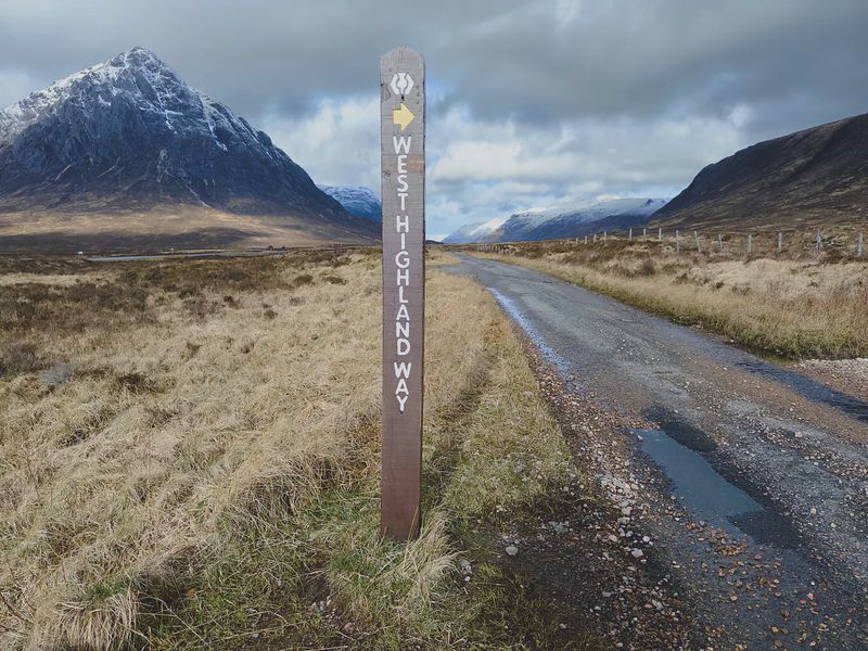
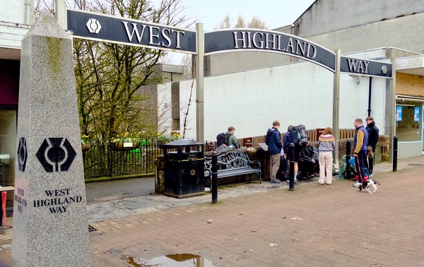
The West Highland Way is a 154 km (9 mile) walking trail in Scotland, running from Milngavie (near Glasgow) to Fort William. It passes through diverse landscapes, including Loch Lomond, open moors, and mountainous terrains. You can view entire route here. (Map by Westhighlandway.org
My Route Today#
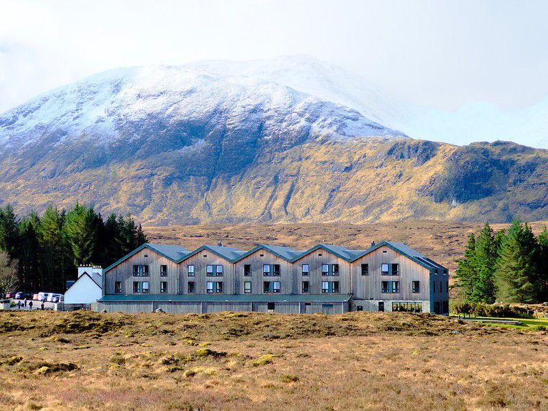
Setting out from the Kingshouse Hotel#
I had a deep, dream-filled sleep at the hotel, which is not too surprising maybe given I’d zonked myself out with a full muscle relaxant pill. I only ever, very periodically, use half a pill at home, so taking a whole pill really did the trick.
I wasn’t over my head and chest cold by a long shot, but I felt like I had a store of energy again. I’d decided the day before to skip the 31 km leg from Tyndrum to the Kingshouse Hotel, feeling it was absolutely necessary because of the state of my health. That turned out to be the wisest decision I could have made. After a day of rest and a great sleep, I again had the strong urge to get out walking.
Today’s leg was shorter than most, an estimated 15 km, but it involved climbing the Devil’s Staircase. The name itself instills a certain amount of dread, which I half-assumed was at least partly mere “marketing”. In fact, though, the climb involved reaching the highest point along the entire West Highland Way and is one of the steepest climbs. This would be no cakewalk.
I was now in the habit of frequently checking the weather reports that covered the leg I was about to walk, and saw that it was snowing in Kinlochleven, my end goal for the day. I knew there would be a pretty substantial elevation gain, so that meant inevitable wind, and that would mean inevitable cold. I decided to put on my light thermal long underwear, both top and bottoms, and for the first time wore the same toque I wear during Edmonton winters. I also packed an extra top layer in case I needed it. Preparing for the cold really made a difference today because, despite any strong, cold winds, I stayed relatively warm the entire day.
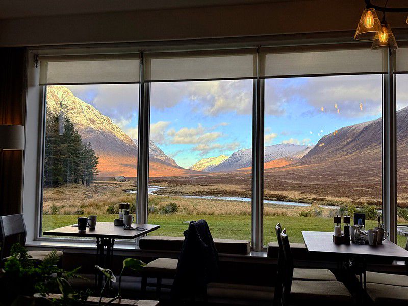
I left the hotel around 9 a.m. and started out on the trail again. It felt so good to be out walking! And I was so lucky and thankful there were blue skies, at least during the first half of the trek oday. The first part of the morning’s walk was truly invigorating, partly because of the periodic blue skies, but mostly because of the awesome, postcard-worthy views of the mountains early in the hike.
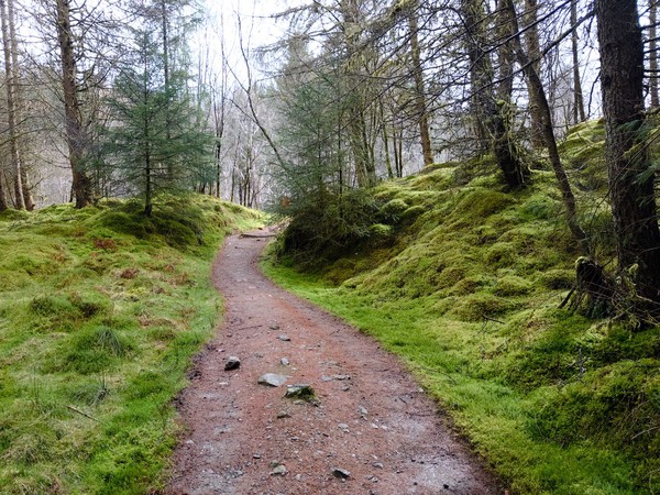
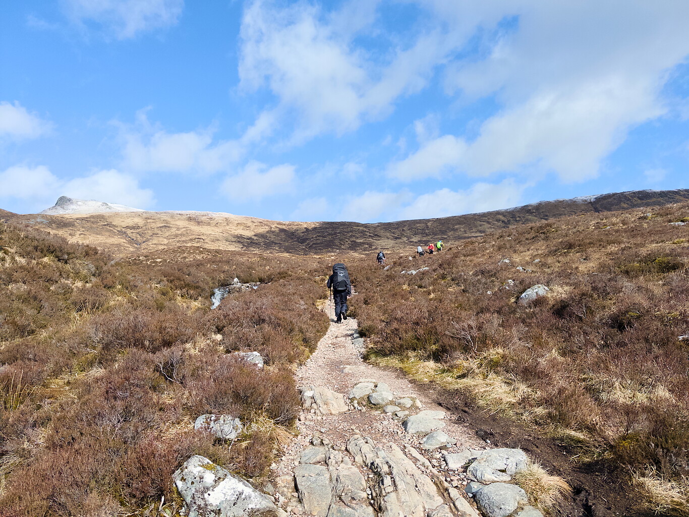
After leaving the hotel one follows a track which eventually shifts to an old, rocky military road undulating with a little bit of elevation gain and loss.
Gallery of Images Taken North of Kinghouse Hotel Before Reaching The Devil’s Staircase#
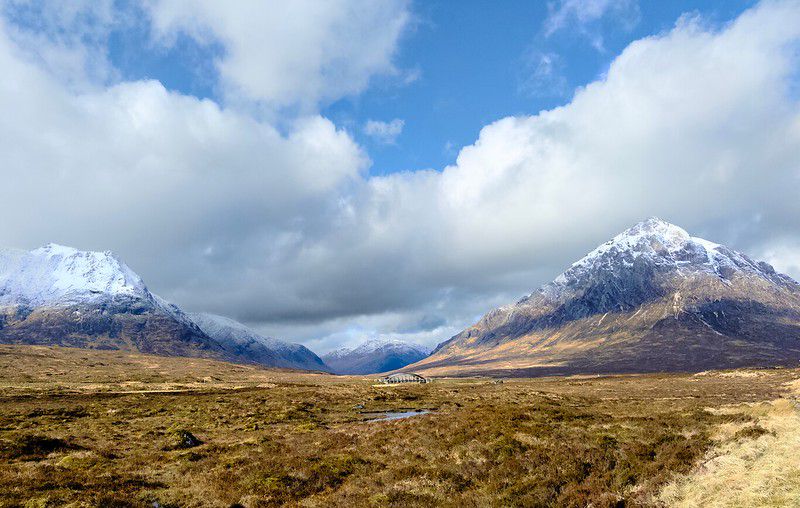
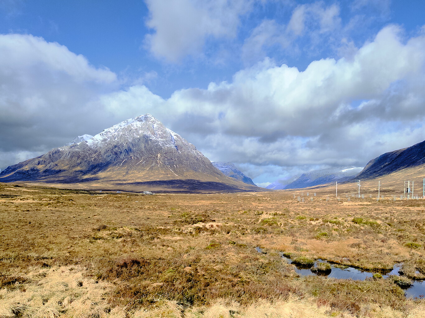
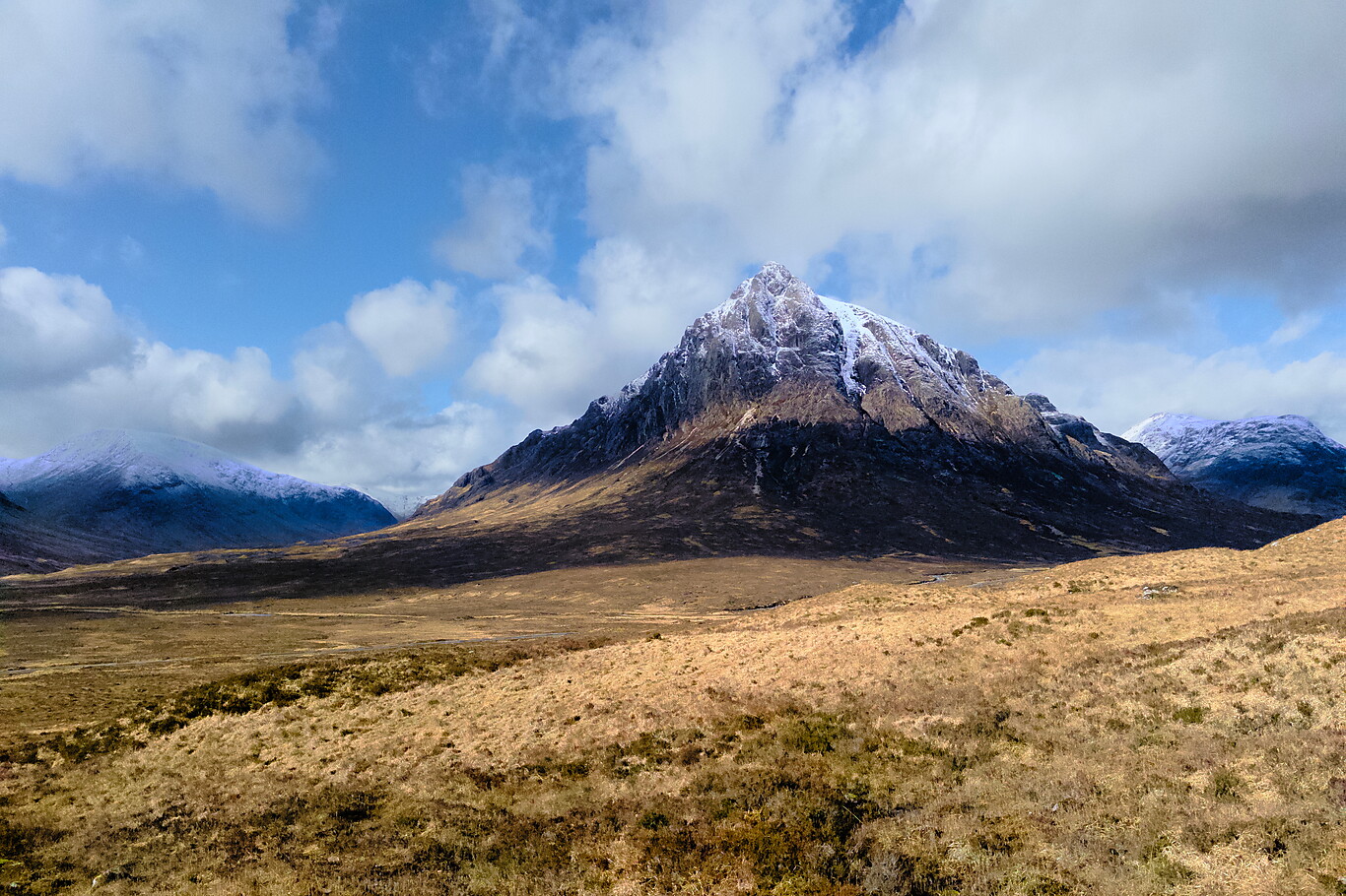
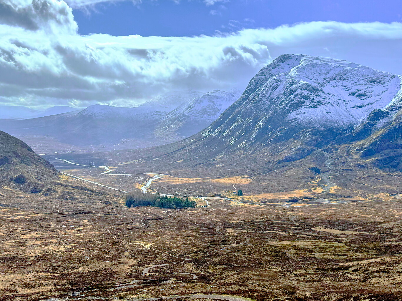
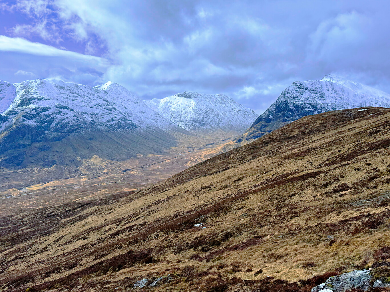
The star of the show in most of these pictures is Buachaille Etive Mòr. The Etive is the primary river running through the valley here and the mountain’s name translates as “The Great Herdsman of Etive”. Multiple sources says it’s probably the most photographed mountain in the country. I had no idea about that at the time, but the number of photos I took of it and around it shows how enthralled I was with it.
(Click to see a larger version)
The Buachaille Etive Mòr from a distance
Camera Model: iPhone 15 Pro
Click for Map Location:N 56.6529639 W 4.8400972
The Buachaille Etive Mòr from a distance

A view to the south from the trail afer starting out from Kingshouse Hotel
Camera Model: iPhone 15 Pro
Click for Map Location:N 56.6535750 W 4.8408806
A view to the south from the trail afer starting out from Kingshouse Hotel
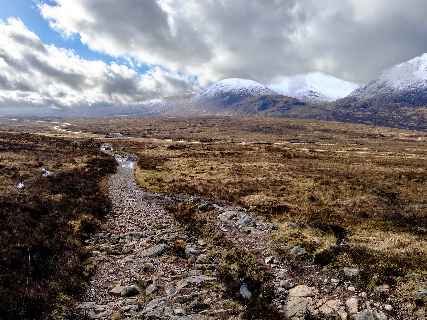
The Buachaille Etive Mòr ahead on the trail
Camera Model: iPhone 15 Pro
Click for Map Location:N 56.6534806 W 4.8530556
The Buachaille Etive Mòr ahead on the trail
The transition onto another section of military road.
Camera Model: iPhone 15 Pro
Click for Map Location:N 56.6539222 W 4.8553944
The transition onto another section of military road.

You can tell this road is old weathered and well-beaten down.
Camera Model: iPhone 15 Pro
Click for Map Location:N 56.6549583 W 4.8570250
You can tell this road is old weathered and well-beaten down.
Looking back southwest from the trail.
Camera Model: iPhone 15 Pro
Click for Map Location:N 56.6550500 W 4.8571500
Looking back southwest from the trail.
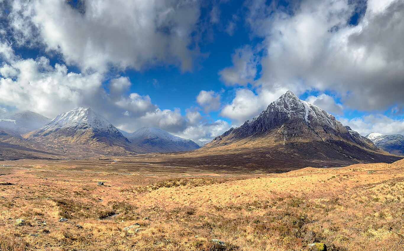
The Buachaille Etive Mòr commands the view
Camera Model: iPhone 15 Pro
Click for Map Location:N 56.6584389 W 4.8642278
The Buachaille Etive Mòr commands the view
Another capture of this awesome place
Camera Model: iPhone 15 Pro
Click for Map Location:N 56.6584361 W 4.8642167
Another capture of this awesome place

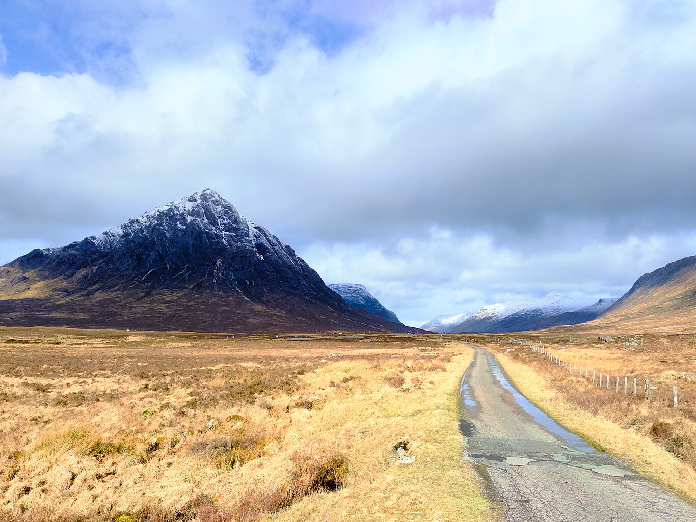
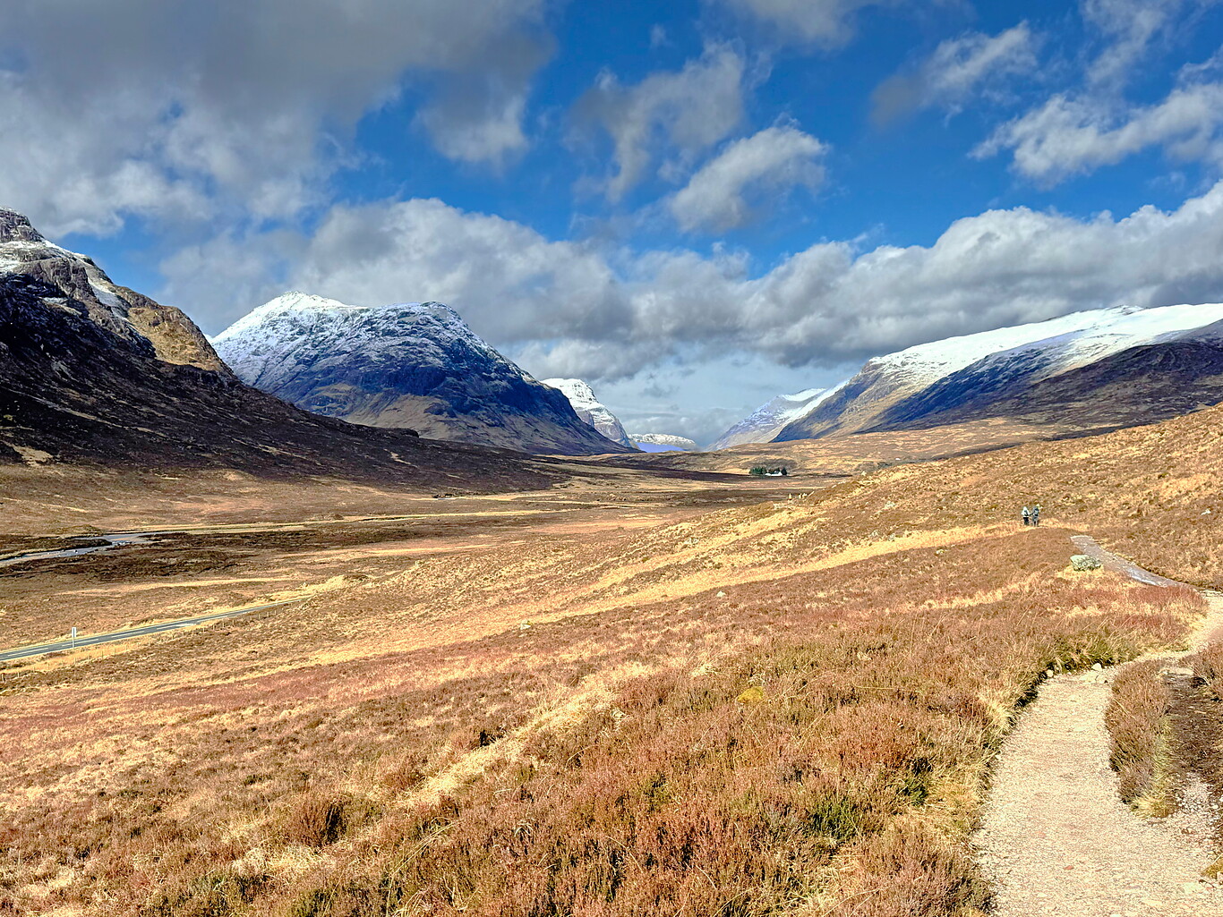
Buachaille Etive Mòr at right and the West Highland Way trail at left
Camera Model: iPhone 15 Pro
Click for Map Location:N 56.6584361 W 4.8642194
Buachaille Etive Mòr at right and the West Highland Way trail at left
Heading deeper into the valley
Camera Model: iPhone 15 Pro
Click for Map Location:N 56.6592944 W 4.8785250
Heading deeper into the valley
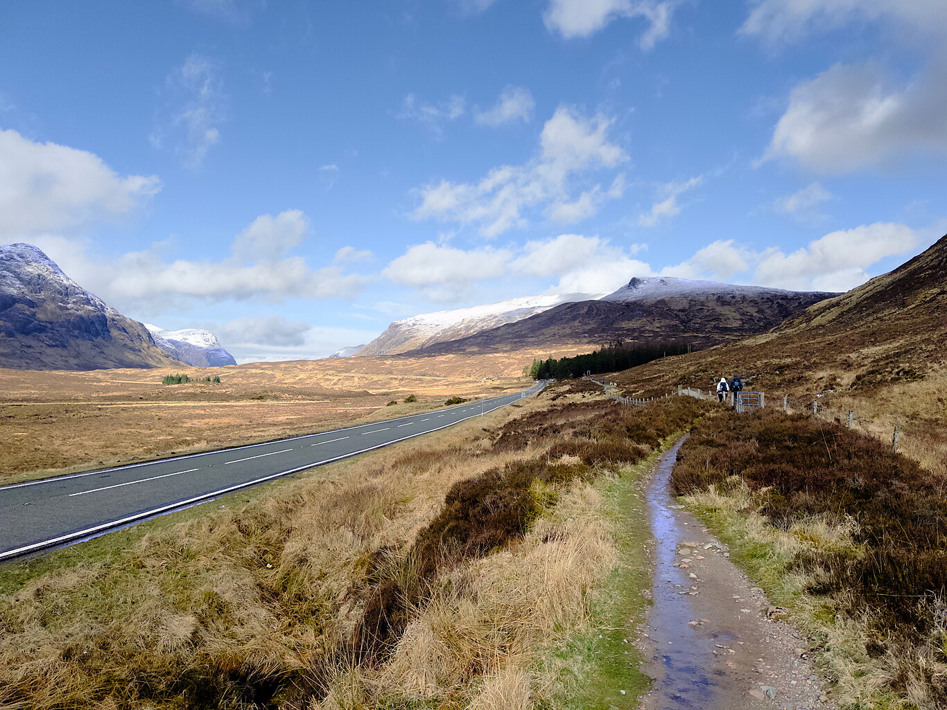
Getting closer to the Devils Staircase
Camera Model: iPhone 15 Pro
Click for Map Location:N 56.6619028 W 4.8928222
Getting closer to the Devils Staircase

A trail marker with the hut called the Wee White House Glencoe in the background. It is owned by the National Trust and Scottish Mountaineering Club
Camera Model: iPhone 15 Pro
Click for Map Location:N 56.6640194 W 4.8998556
A trail marker with the hut called the Wee White House Glencoe in the background. It is owned by the National Trust and Scottish Mountaineering Club
The Devil’s Staircase#
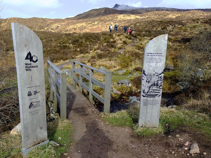
In the end, though, I admit, prairie boy that I am, I found the Devil’s Staircase to be a tough climb and I needed to rest fairly often on the way up. But it was the same for everyone around me. In fact, a pattern developed: a woman with a blue jacket, a guy with a black backpack and I just happened to continue leap-frogging each other as we gradually ascended the slope. While I rested, one or both of them would pass me by, and in turn I’d pass one or both of them while they took a breather.
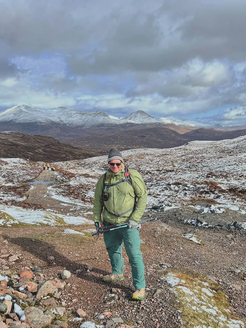
At the top — which is the highest point along the entire West Highland Way — the woman with the blue jacket signalled, asking if I wanted her to take a picture of me. I gave her my phone, she took a few, and I swear while she was doing that the wind at the top where we were almost blew me over. I had to plant my feet solidly just so the wind wouldn’t topple me over while she took the pictures. I offered to take her picture, but she indicated she wasn’t interested in that.
Descent to Kinlochleven#
Now, for almost the entire remaining section of the walk it was downhill all the way into Kinlochleven. Of course, going downhill generally wears harder on the knees than going up, so as I walked I did all I could to put pressure on my poles in front of me to ease the strain on the knees. My right leg did start to complain on the way down, but not to the degree that it slowed me down much.
It was a long, long steep descent to Kinlochleven, but almost entirely on established roads. I arrived around 1 p.m., and my accommodation at Allt Na Leven B&B was advertised as not being open until 3 p.m. I rested on benches for a while, checked out the local Co-op since I knew I’d be buying food there for supper, and walked around the village for a bit.
I later got up and walked across the street to the Co-op, where I got a prepared sandwich, a quart of milk and a protein bar for supper.
I had a very good sleep again at Allt Na Leven B&B, again with the help of a muscle relaxant pill to help me sleep.
Tomorrow would be the very last leg of the entire West Highland Way.
Gallery#
(Click to see a larger version)

Looking back after crossing another bridge along the path. I couldnt let those stunning mountains leave my sight it seems
Camera Model: iPhone 15 Pro
Click for Map Location:N 56.6667889 W 4.9055806
Looking back after crossing another bridge along the path. I couldnt let those stunning mountains leave my sight it seems
The fellow with the black backpack on the rugged trail
Camera Model: iPhone 15 Pro
Click for Map Location:N 56.6676722 W 4.9064694
The fellow with the black backpack on the rugged trail
Again looking back to the valley Id just come from
Camera Model: iPhone 15 Pro
Click for Map Location:N 56.6744417 W 4.9138556
Again looking back to the valley Id just come from
A view further north down the valley
Camera Model: iPhone 15 Pro
Click for Map Location:N 56.6744306 W 4.9138639
A view further north down the valley

The fellow with the black backpack. We leapfrogged all the way to the top.
Camera Model: iPhone 15 Pro
Click for Map Location:N 56.6748861 W 4.9143806
The fellow with the black backpack. We leapfrogged all the way to the top.
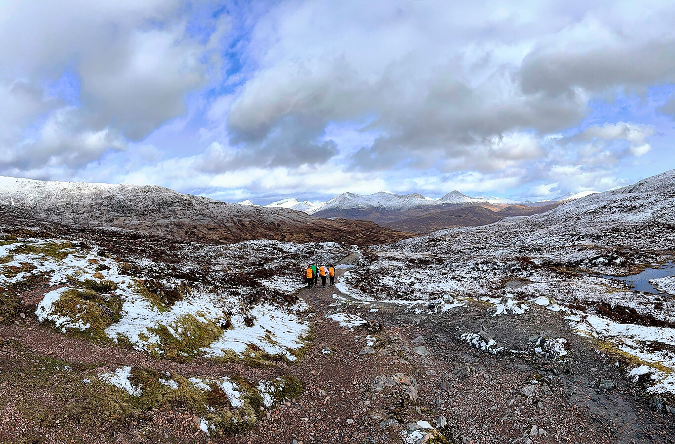
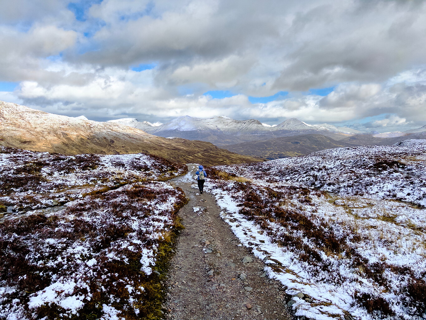
The expansive view from the highest point
Camera Model: iPhone 15 Pro
Click for Map Location:N 56.6762111 W 4.9143556
The expansive view from the highest point
The woman with the blue jacket continues on her way
Camera Model: iPhone 15 Pro
Click for Map Location:N 56.6763722 W 4.9144528
The woman with the blue jacket continues on her way
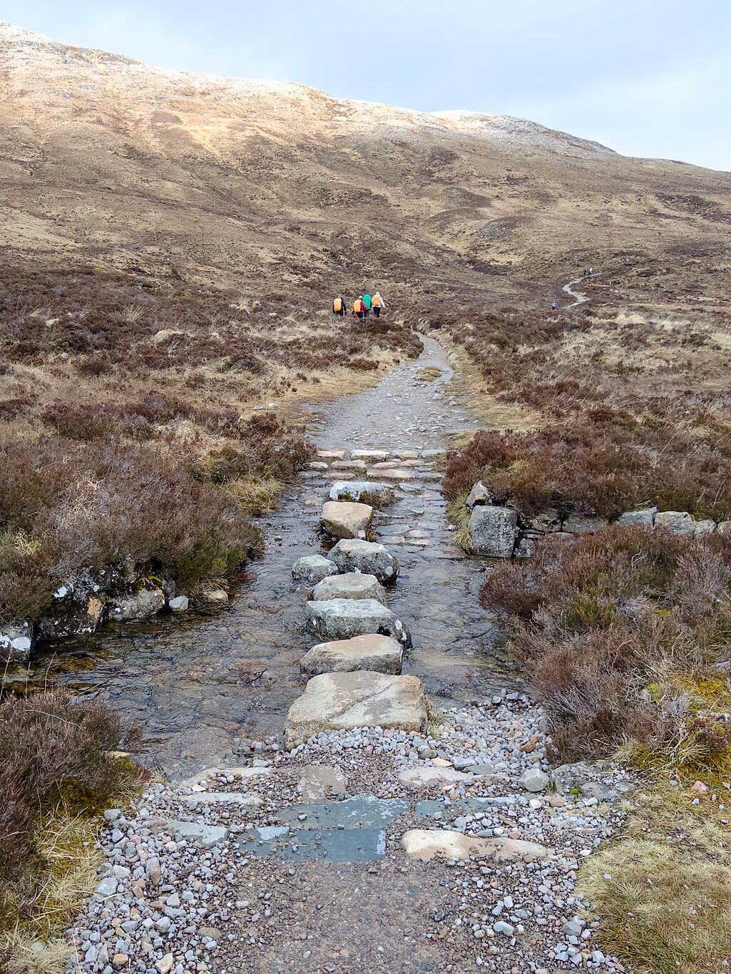
Stepping stones over a boggy area
Camera Model: iPhone 15 Pro
Click for Map Location:N 56.6808472 W 4.9179333
Stepping stones over a boggy area
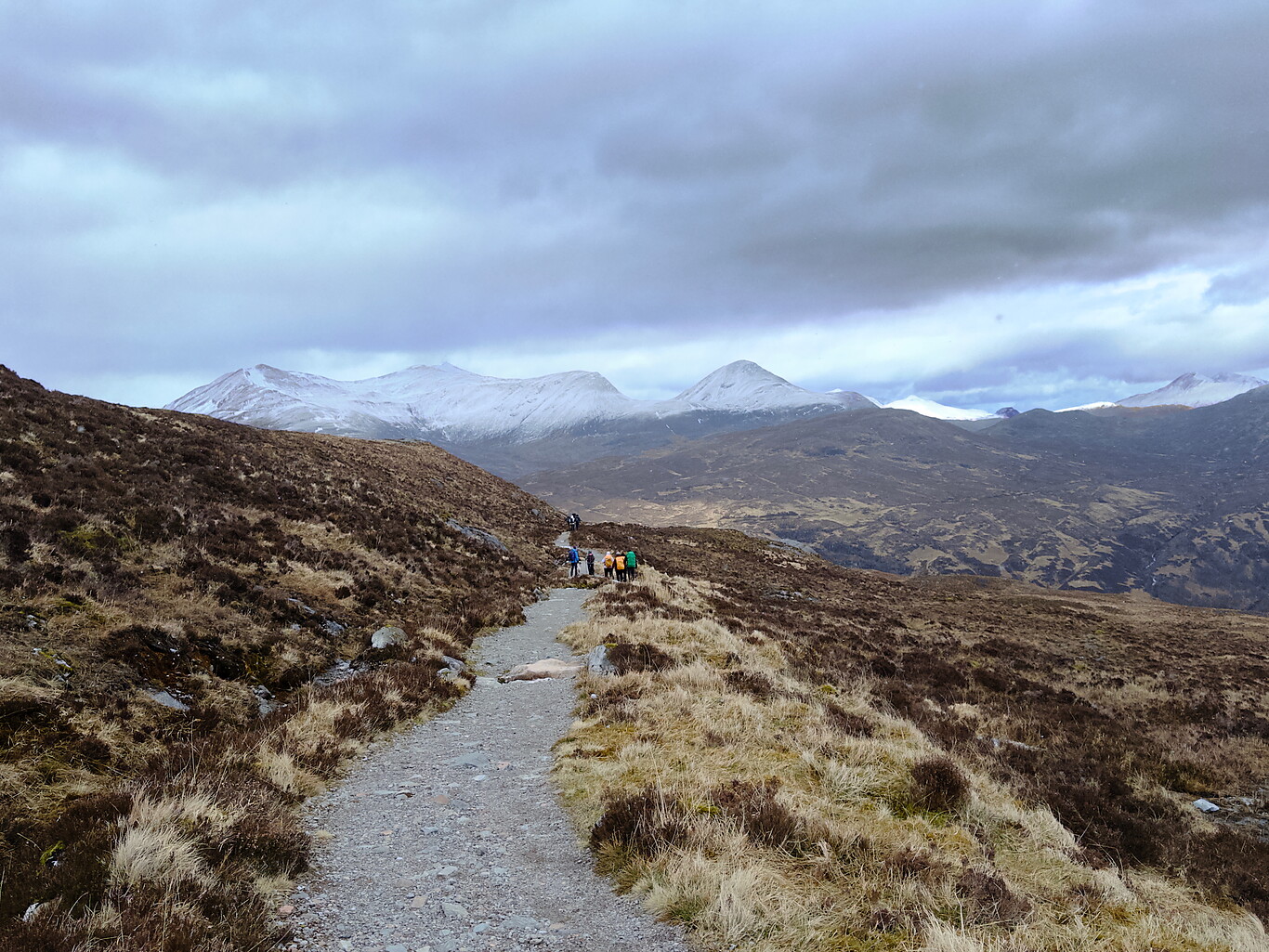
Descending gradually but theres still a commanding view
Camera Model: iPhone 15 Pro
Click for Map Location:N 56.6878250 W 4.9160944
Descending gradually but theres still a commanding view

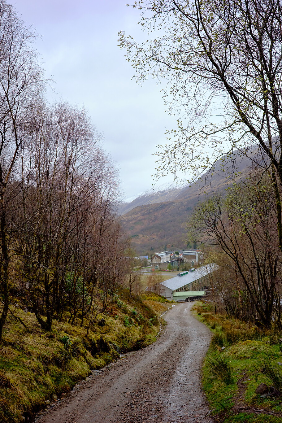
A typical shot of the road descending to Kinlochleven
Camera Model: RICOH GR IIIx
Click for Map Location:N 56.7036111 W 4.9510778
A typical shot of the road descending to Kinlochleven
Kinlochleven in view
Camera Model: RICOH GR IIIx
Click for Map Location:N 56.7111833 W 4.9521528
Kinlochleven in view

A very large group of hikers passed me just before reaching town
Camera Model: RICOH GR IIIx
Click for Map Location:N 56.7119528 W 4.9552611
A very large group of hikers passed me just before reaching town
Kinlochleven after a rain
Camera Model: RICOH GR IIIx
Click for Map Location:N 56.7134250 W 4.9630306
Kinlochleven after a rain
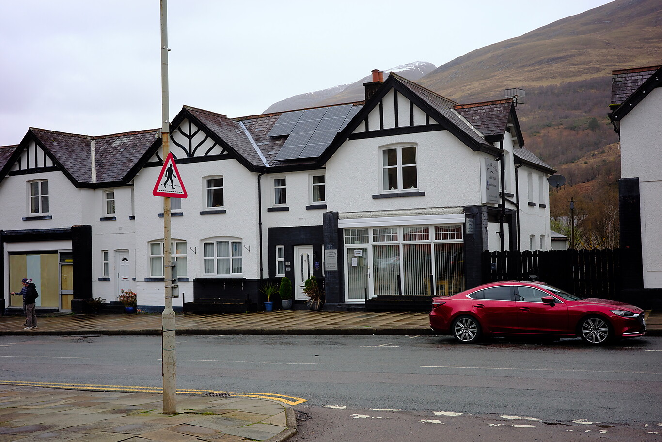
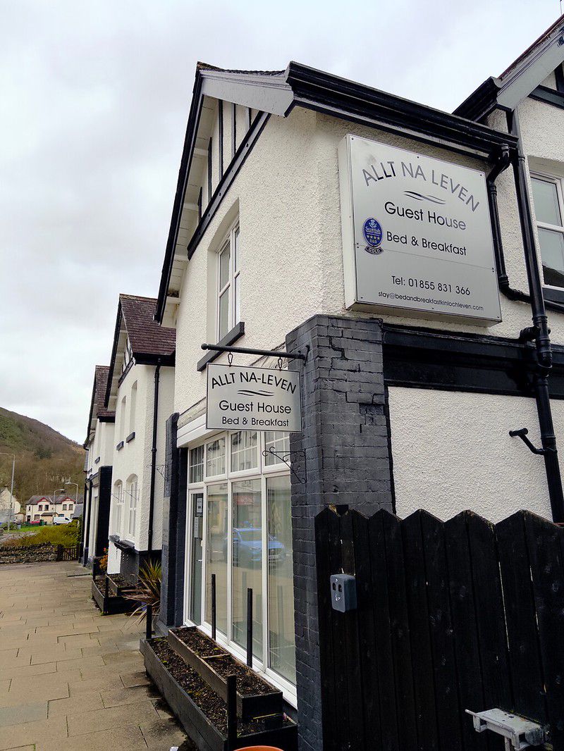
Allt-na-Leven Guesthouse-my accommodation for the night
Camera Model: RICOH GR IIIx
Click for Map Location:N 56.7133194 W 4.9632611
Allt-na-Leven Guesthouse-my accommodation for the night

The River Leven which runs through the center of the village
Camera Model: iPhone 15 Pro
Click for Map Location:N 56.7140389 W 4.9636722
The River Leven which runs through the center of the village
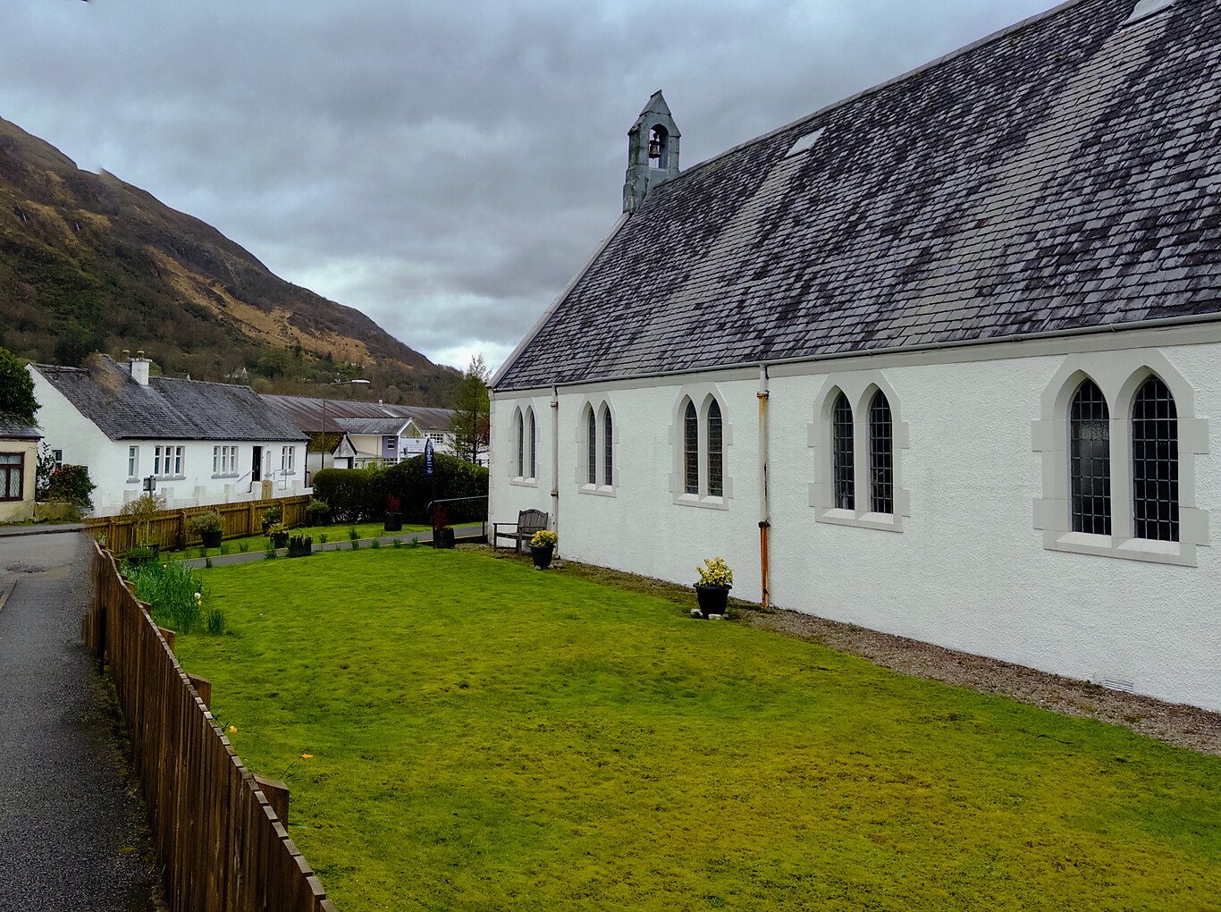
Kinlochleven Parish Church
Camera Model: iPhone 15 Pro
Click for Map Location:N 56.7150444 W 4.9644361
Kinlochleven Parish Church

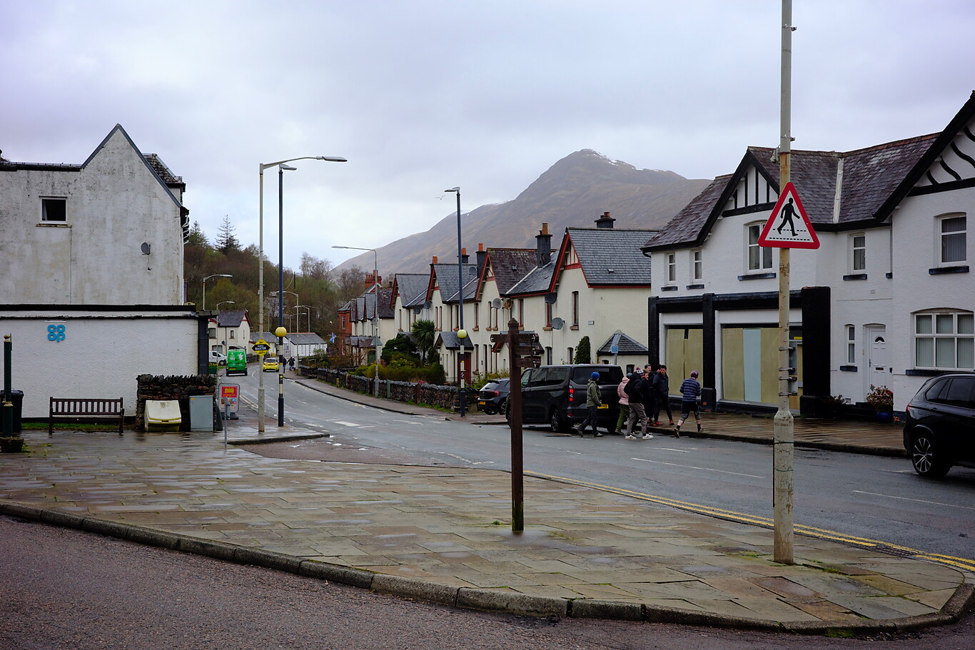
A typical Scottish street— white lime-based paint provides the best weather protection
Camera Model: iPhone 15 Pro
Click for Map Location:N 56.7155472 W 4.9656944
A typical Scottish street— white lime-based paint provides the best weather protection

A view from the bridge that connects the two areas of the village
Camera Model: iPhone 15 Pro
Click for Map Location:N 56.7141722 W 4.9628972
A view from the bridge that connects the two areas of the village

West Highland Way - 2026 - This article is part of a series.
Related
West Highland Way - Day 2 - Drymen to Rowardennan
West Highland Way - Day 1 - Milngavie to Drymen