Climb to the Summit of Horton's Hill
Kananaskis Summer Trip - 2025 - This article is part of a series.
I’ve harboured a recurring desire to climb Horton’s Hill for years. Years.
My past visits to Kananaskis have usually been centered around the north section of this big, beautiful park, with the dusty, graveled Highway 68 as the backbone of my visits.
Geocaches hidden in this area have been the lure to keep me returning. I still think of my very first visit to Kananaskis in 2010 when I climbed up to find the Lusk Creek Central Summit cache as magical. That off trail, out of the envelope experience for me at the time simply put the hook in me and hasn’t yet let go.
After parking and getting geared up, I headed toward what promised on the OSM map to be the trailhead. Sure enough, the trail was there, and sure enough, echoing some comments in cache logs I’d read, the way up was steep!
As I ascended, I simply reminded myself of my favourite mantra: “I’ve got all day” and added to that, “Just rest and recover when you need to”. The experience of what was for me a completely “out of the envelope” experience of climbing Mt Burke two days before gave me new, confident expectations that I would and could endure anything this “hill” was going to challenge me with. I’d endured that mountain climb; surely I could endure this.
That base of psychological assuredness simply erased any doubt of a successful climb today and turned the focus into a continuous mental cycle of “climb - rest - climb - rest” versus a “climb - will I make it? - climb - should I quit?” cycle.
As I ascended, there were stops and a couple of detours to find geocaches, some being easier to locate than others. But after I’d gained enough elevation, the real “finds” of the day were the views to the northeast. It’s amazing that such a relatively small change on the map can alter one’s perspective and deepen one’s sheer appreciation of the beauty of this Earth we inhabit.
This appreciation is the basic point of every activity you might see on this website.
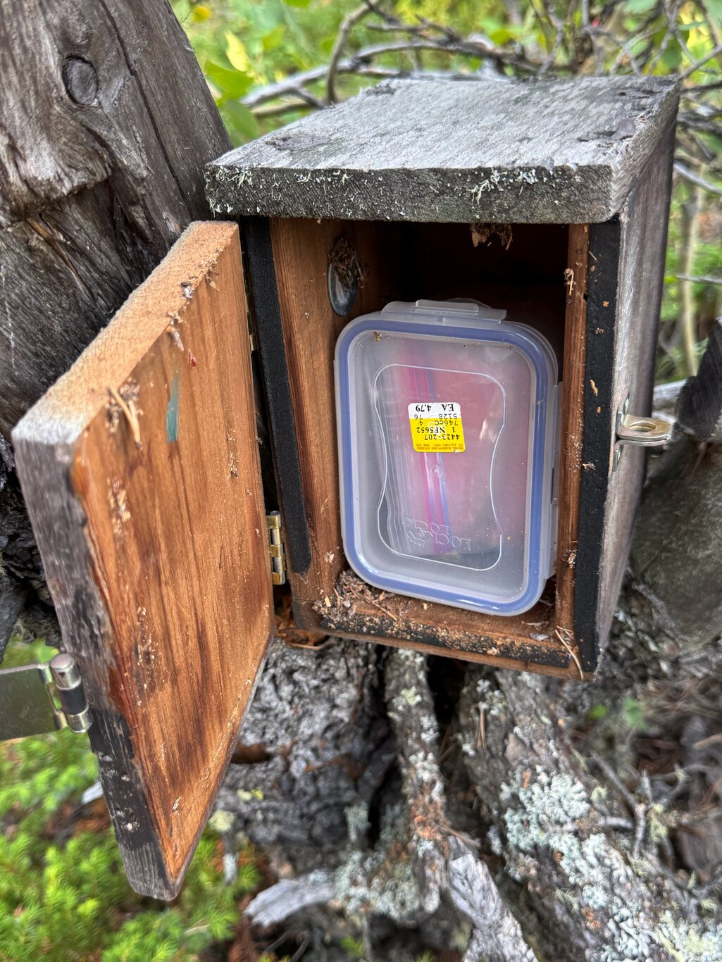
After that, I located one of the “must-find” geocaches of the day: an older cache, hidden by a geocacher known to create high-quality cache containers. And once I’d found this cache, I saw it was certainly another example of just that.
I don’t usually publicly post images of found caches, but in this case, I’m making an exception: the cache container is just so nicely done that I feel compelled to share its double-double coolness. See it in the gallery below.
I took an alternate route back down the hill because caches were hidden along what was said to be an alternate trail back to the trailhead. That "trail" mostly didn't exist, so the experience of descending the hill was part wayfinding, bushwhacking with the occasional practice of all the Anglo-Saxon words I knew, using them in different orders for variety.
I managed to get back to level ground though, this time in view of some picnickers who gazed up at me and must have wondered about the state of my sanity as I emerged from the bush and returned to the parking lot.
Gallery#
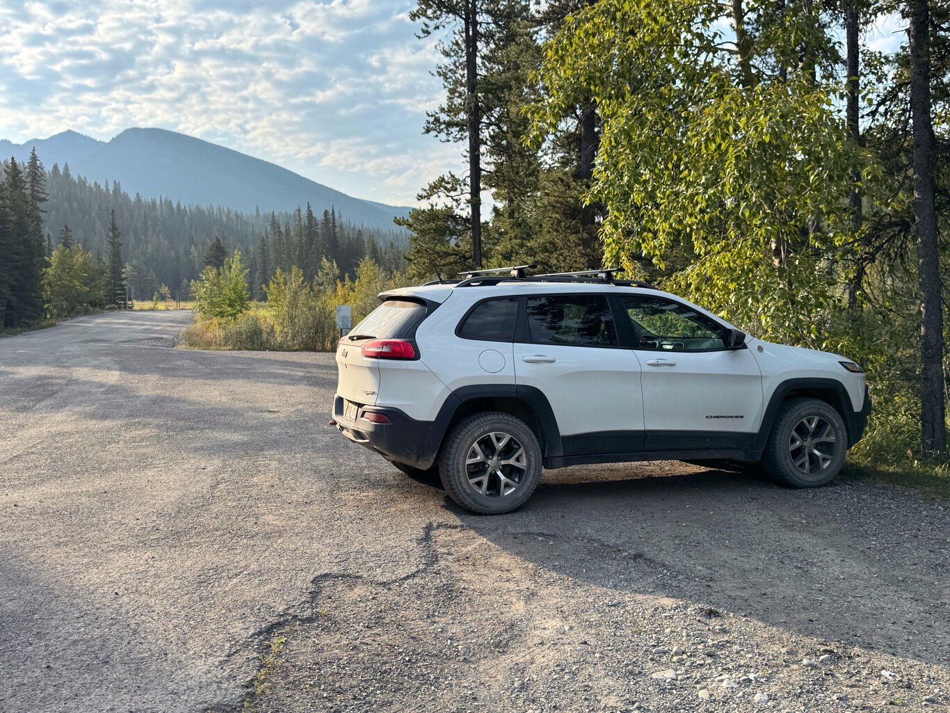
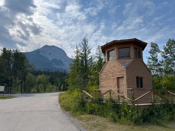
Parked at the Lusk Creek Provincial Rec Area
Camera Model: iPhone 15 Pro
Click for Map Location:N 51.0329056 W 115.0139083
Parked at the Lusk Creek Provincial Rec Area

A shot of the trail as I started up the hill
Camera Model: iPhone 15 Pro
Click for Map Location:N 51.0344500 W 115.0162500
A shot of the trail as I started up the hill
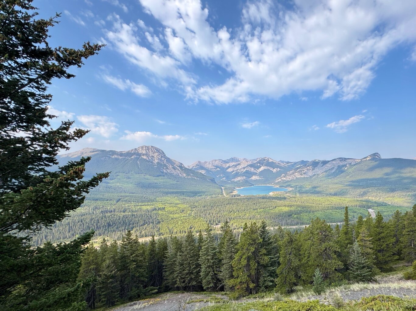
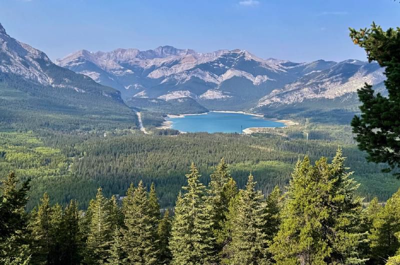
Barrier Lake nestled in amongst mountain and forest
Camera Model: iPhone 15 Pro
Click for Map Location:N 51.0374639 W 115.0109028
Barrier Lake nestled in amongst mountain and forest
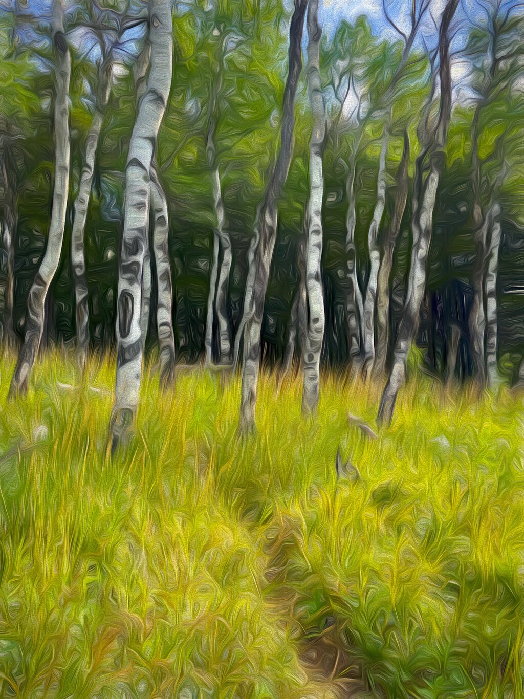
An arty version of a poplar grove
Click for Map Location:N 51.0376861 W 115.0107278
An arty version of a poplar grove

This tree wasn't completely sure of where it was going either
Camera Model: iPhone 15 Pro
Click for Map Location:N 51.0382389 W 115.0075917
This tree wasn't completely sure of where it was going either
One the first memorable geocache finds
Camera Model: iPhone 15 Pro
Click for Map Location:N 51.0387806 W 115.0069667
One the first memorable geocache finds

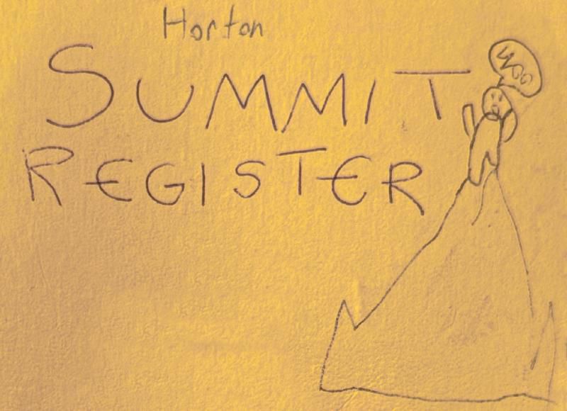
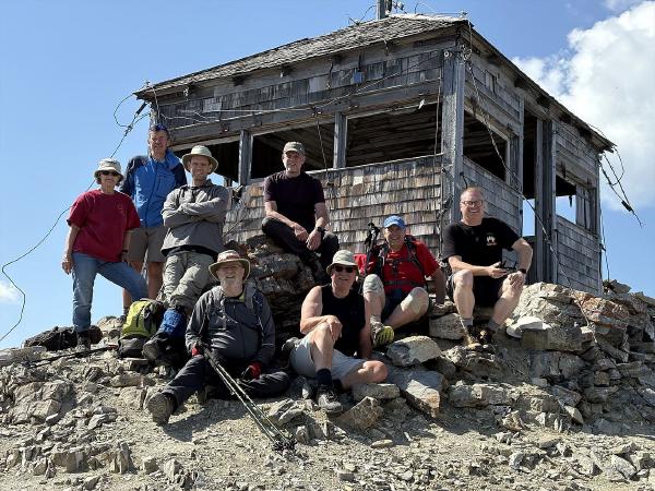
How I found the summit register - which I didn't know existed before arriving
Camera Model: iPhone 15 Pro
Click for Map Location:N 51.0427389 W 115.0029667
How I found the summit register - which I didn't know existed before arriving
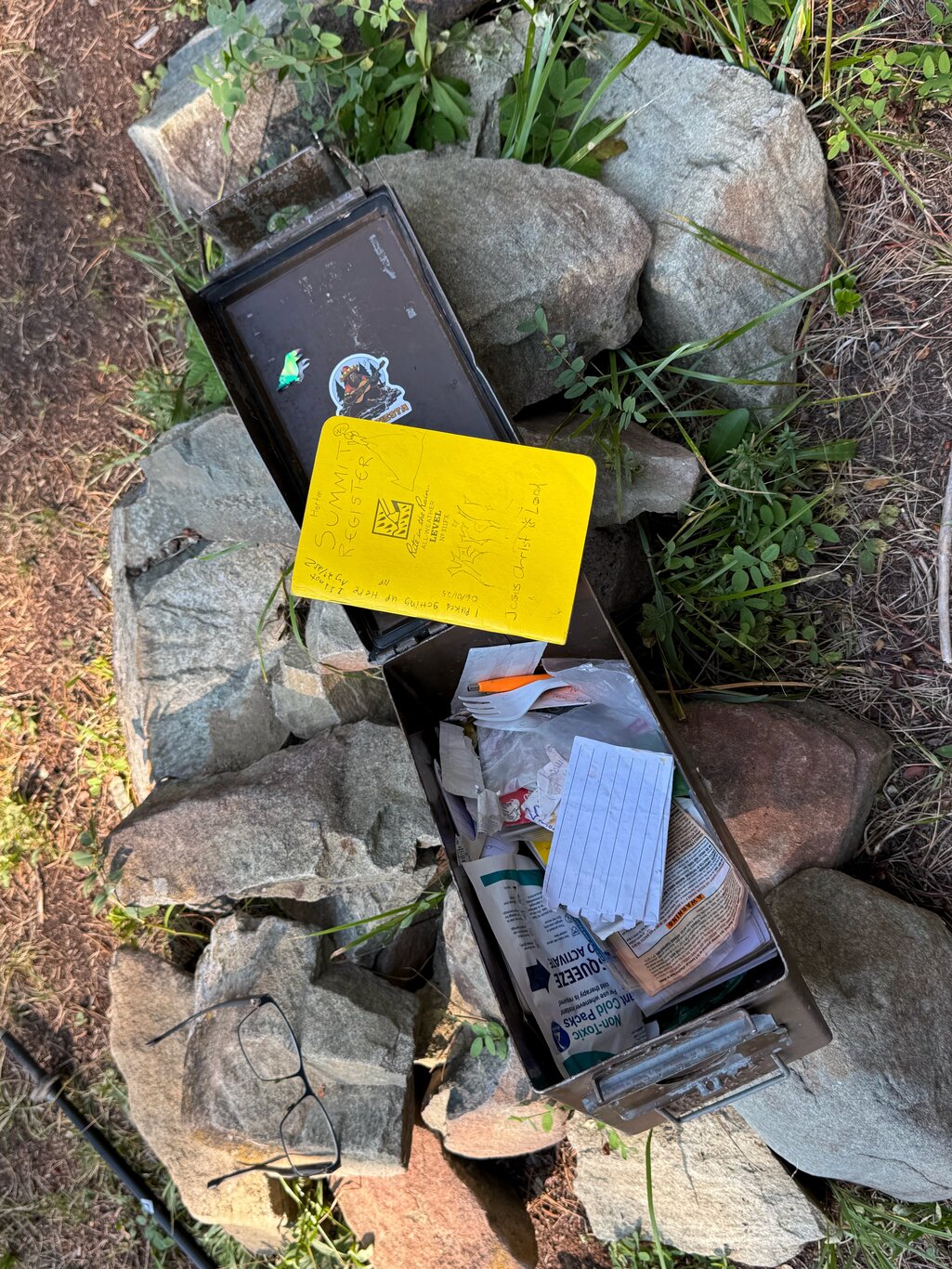
The summit register ammon can and contents
Camera Model: iPhone 15 Pro
Click for Map Location:N 51.0420417 W 115.0025111
The summit register ammon can and contents
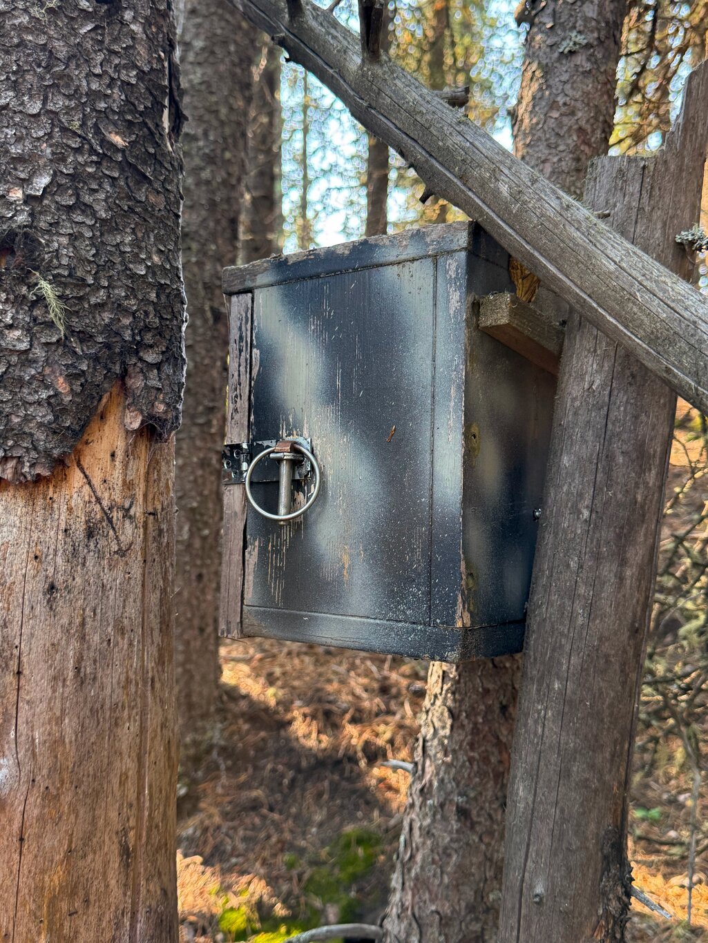
An exceptional geocache hide - first glimpse
Camera Model: iPhone 15 Pro
Click for Map Location:N 51.0418278 W 115.0019000
An exceptional geocache hide - first glimpse

The "Horton's Hill" cache - what a fun find!
Camera Model: iPhone 15 Pro
Click for Map Location:N 51.0421528 W 115.0022667
The "Horton's Hill" cache - what a fun find!
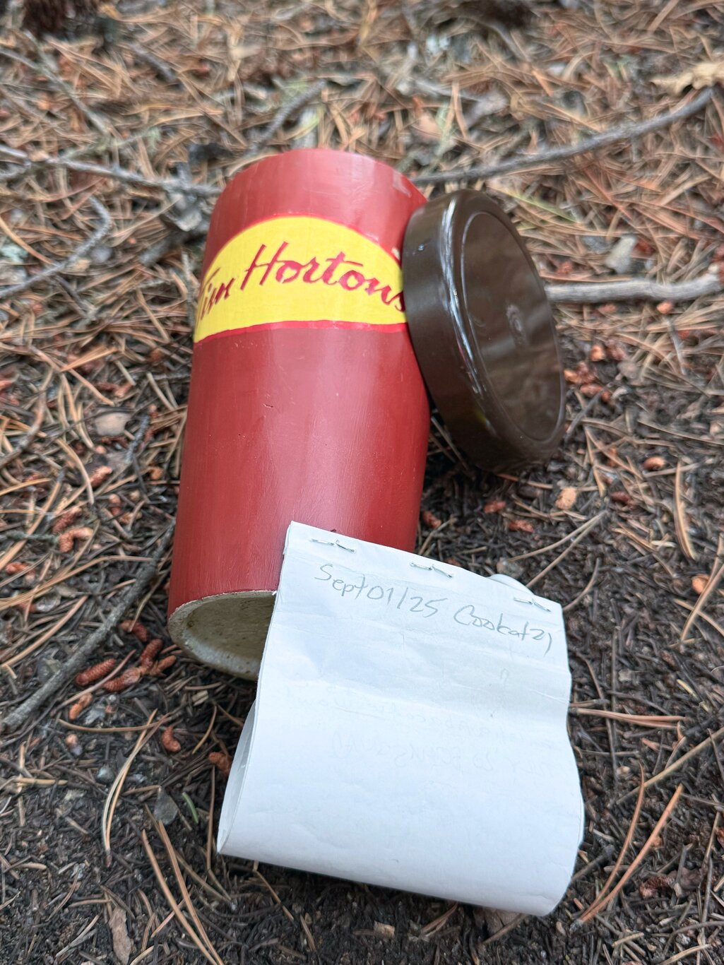
The Tim's cup contains the log book
Camera Model: iPhone 15 Pro
Click for Map Location:N 51.0421139 W 115.0023111
The Tim's cup contains the log book

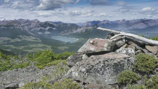
Barrier Lake with the slope of Horton's Hill in the foreground
Camera Model: iPhone 15 Pro
Click for Map Location:N 51.0426944 W 115.0040806
Barrier Lake with the slope of Horton's Hill in the foreground

Some human's attempt to point the way when the way is forever fluid
Camera Model: iPhone 15 Pro
Click for Map Location:N 51.0405528 W 115.0066611
Some human's attempt to point the way when the way is forever fluid
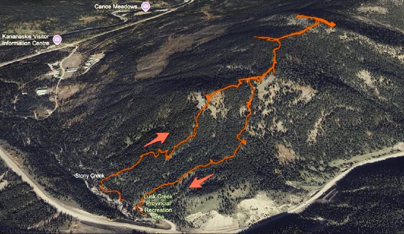
My Route Today#

Kananaskis Summer Trip - 2025 - This article is part of a series.
Related
The Path to Finding "Pathfinder"
The Climb to the Summit of Mt Burke